

Community
South Coast Rail introduces interactive map
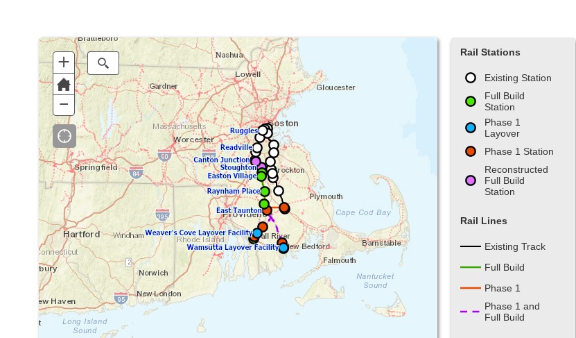
Want to know where your home is located compared to the South Coast Rail tracks and stations?
Today MassDOT released an interactive corridor map that lets you zoom in to any location in the area to see where it is located compared to phase 1 of the South Coast Rail project.

The interactive corridor map provides a detailed, street-by-street view of the entire Phase 1 and Full Build corridors, including each station and layover facility. You can enter a property’s street address to locate where a property is in relation to the tracks.


You must be logged in to post a comment Login