
Community
Wind and rain forecasts increased ahead of weekend storm
A developing nor’easter is expected to begin impacting the New England region early Saturday morning through Saturday night, with the highest impacts forecast to occur during the day on Saturday.
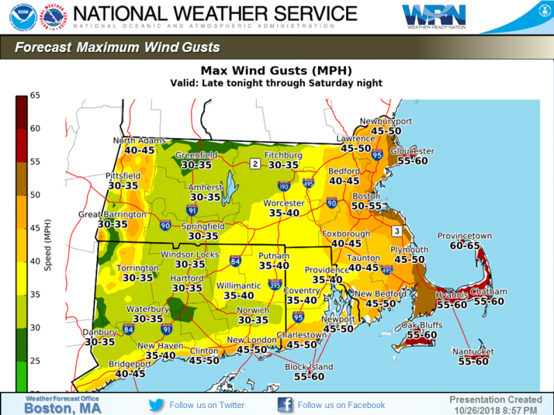
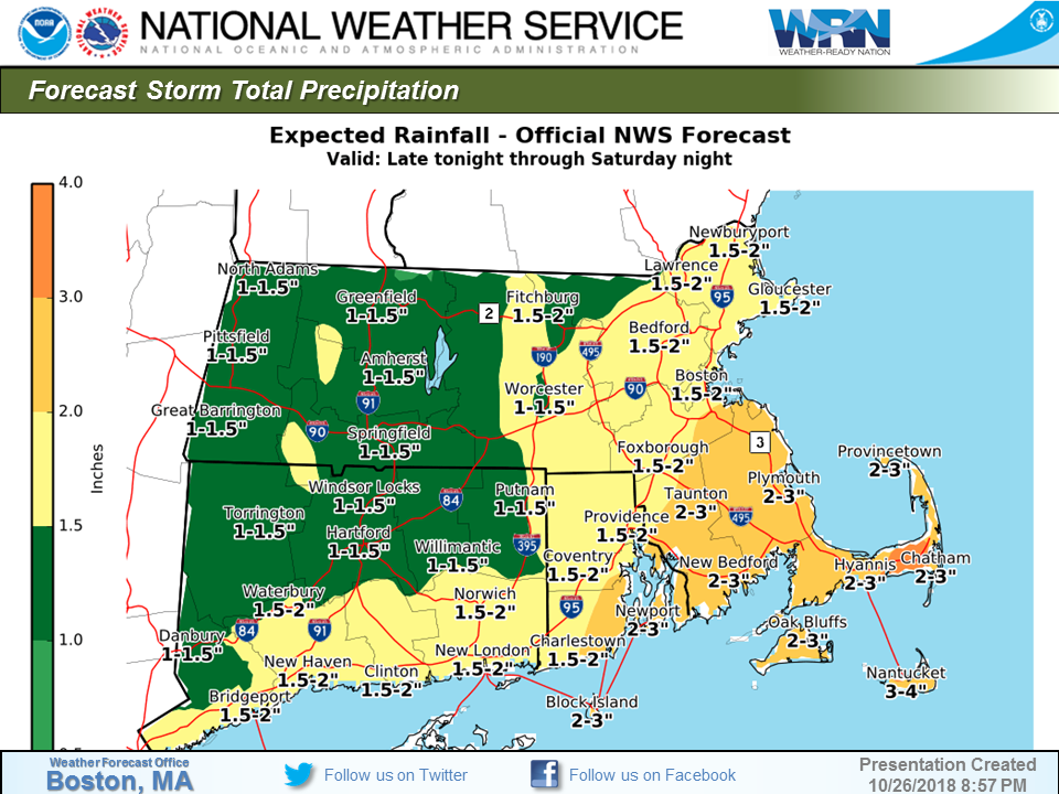
Widespread rainfall totals of 1 to 2 inches are forecast with locally higher amounts of 2-4 inches possible, especially across southeastern Massachusetts. Northeast winds gusting to 30-45 MPH are likely across the region on Saturday, and gusts of up to 60 MPH are possible along the immediate south and southeast coasts, including the Cape and Islands.
Beach erosion and widespread minor coastal flooding is forecast along the eastern Massachusetts coast on Saturday, especially from the North Shore to coastal Plymouth County, but also including the Cape and Islands. Some more vulnerable coastal communities such as Scituate could experience pockets of low-end moderate coastal flooding. Although it is not likely at this time, more pockets of moderate coastal flooding could occur if winds and seas build up earlier than forecast. Communities along the south coast may experience a few pockets of minor coastal flooding or splashover, but impacts in this region are expected to be minimal. Flooding is not expected to occur during the high tide late Saturday night, which is about one foot lower than the Saturday afternoon high tide. Winds and seas are expected to subside Saturday night.

Impacts:
· Heavy rain may result in ponding of water on roads and flooding of low-lying areas.
· Due to saturated ground and fully leaved trees, wind gusts may cause downed trees/tree branches and isolated power outages. Areas most at risk are the Cape and Islands and Cape Ann.
· Widespread minor coastal flooding may cause beach erosion and inundation of vulnerable shore roads. Some roads may require brief closures around the time of high tide Saturday afternoon.


You must be logged in to post a comment Login