

Community
Still recovering from weekend snowstorm, Massachusetts, Rhode Island expected to see strong, damaging winds, flooding
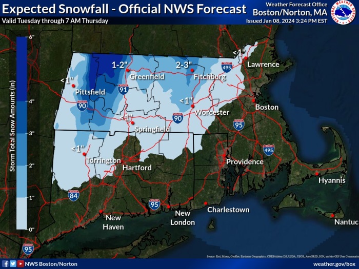
Fresh off a snowstorm, southern New England is now expected to receive damaging winds, flooding rains, and in certain areas, more snow.
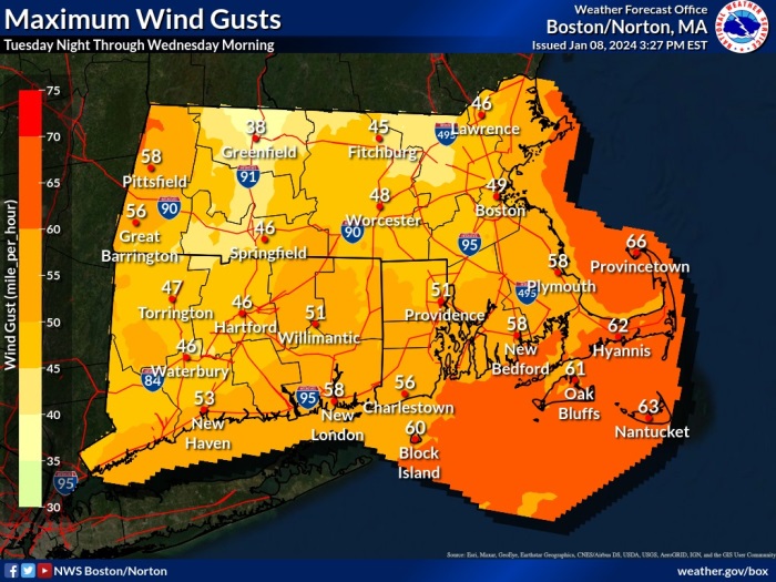
According to the National Weather Service Boston, a High Wind Warning has been issued from 5:00 p.m. Tuesday to 1:00 p.m. Wednesday for Eastern and Southern Plymouth, Washington, Southern Bristol, Barnstable, Dukes, Nantucket, and Newport Counties.
Southeast winds of 30 to 40 mph with gusts up to 65 mph are expected.
Damaging winds could blow down trees and power lines. Power outages are possible. Travel could be difficult, especially for high profile vehicles.
The strongest winds will occur late Tuesday evening through daybreak Wednesday.
People should avoid being outside in forested areas and around trees and branches. If possible, remain in the lower levels of your home during the windstorm, and avoid windows. Use caution if you must drive.

A Coastal Flood Watch has also been issued for late Tuesday through Wednesday morning for Southern Bristol MA County, Southeast Providence RI, Eastern Kent RI, Bristol RI, Washington RI and Newport RI Counties.
One to two feet of inundation above ground level possible in low-lying areas near shorelines and tidal waterways (5.1 to 8.4 feet Mean Lower Low Water).
Minor to perhaps moderate flooding can be expected across low-lying areas of Newport, Middletown and Portsmouth, as well as areas along Narragansett Bay. Several immediate coastal roads will be impassable for a few hours around time of high tide. Beach erosion along the ocean exposed coastline is likely.
If travel is required, allow extra time as some roads may be closed. Do not drive around barricades or through water of unknown depth. Take the necessary actions to protect flood-prone.
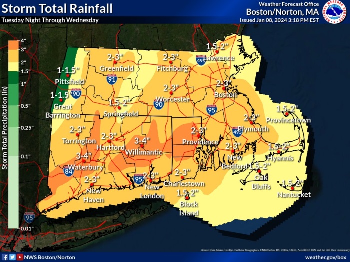
A Flood Watch remains for most of southern New England as excessive rainfall of between two and three inches with locally up to four inches falling Tuesday Night into Wednesday morning in combination with snowmelt may result in rapid stream and river rises. Snow clogged drains may also contribute to the flood risk in poor drainage and urban areas.


You must be logged in to post a comment Login