
Community
Southern New England issued Wind and Frost Advisories, severe thunderstorms possible
Some cold and blustery conditions are headed our way.
According to the National Weather Service, tomorrow, scattered showers will be followed by a line of thunderstorms in the afternoon/evening. Behind these storms strong winds pick up out of the west and may cause some isolated damage.
Before tomorrow’s weather however, we are in for some cold temperatures.
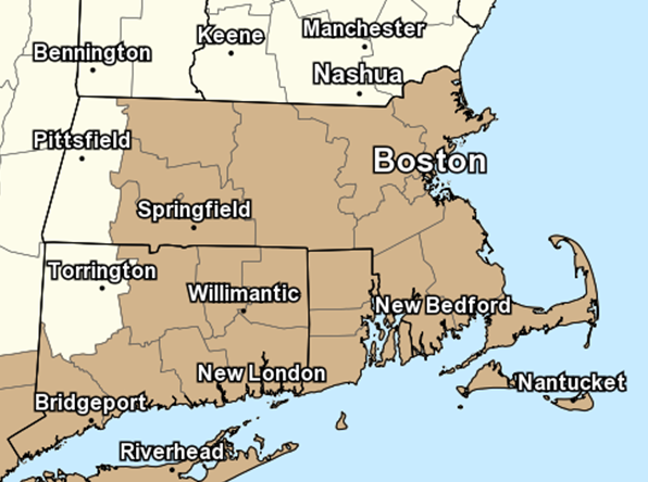
Both Frost and Wind Advisories have been issued for the area.
For the Frost Advisory, temperatures in the low to mid 30s will result in frost formation for portions of northern Connecticut, Rhode Island and portions of Eastern Massachusetts.
For the Wind Advisory, west winds 10 to 20 mph with gusts up to 50 mph expected in all of Southern New England except for Berkshire County in Massachusetts and Litchfield County in Connecticut.

The Frost Advisory is in effect from midnight tonight to 8 AM Tuesday.
The Wind Advisory will be in place from 5 PM Tuesday to 3 AM EDT Wednesday.
Gusty winds could blow around unsecured objects Tuesday. Tree limbs could be blown down and a few power outages may result. Frost could kill sensitive outdoor vegetation if left uncovered.
Use extra caution when driving, especially if operating a high profile vehicle. Secure outdoor objects.
Tonight, take steps to protect tender plants from the cold.


You must be logged in to post a comment Login