

Community
Parts of southern New England could see snow early next week
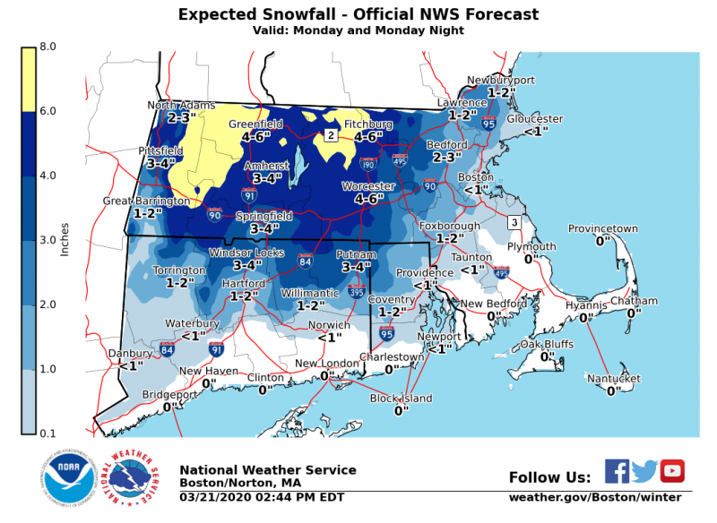
The National Weather Service is reporting that several areas in New England could see accumulating snow, including parts of southern New England.
Here is the latest snow forecast for Monday into Tuesday from the National Weather Service , and maps showing the chances of receiving 2″, 4″, and 6″+ of snow.
Key points:
– Snow will begin across the region Monday afternoon and snow may be heavy for a few hours from late in the day into the evening. Snow should change to rain Monday night.
– The exception is in the higher elevations near the Berkshires and in northern Worcester County where it should remain all snow. 3-6″ of snow is forecast but a few spots could pick up 7″. The consistency of the snow will be wet and heavy.
– Areas near the coast, including Providence and Boston, should see a slushy inch or two of accumulation, mainly on the grass.
– Cape Cod and the Islands can expect mostly rain.

Uncertainty:
– The track of the coastal storm is not yet certain, so winter weather headlines have yet to be issued.
– If the storm tracks farther offshore, snowfall totals would be much less.
– If it tracks closer to us, snowfall totals would also be lower since more rain would be involved and the higher totals would shift to the northwest of Massachusetts.
Currently, Fall River is forecast to see rain, however, areas close to Fall River are forecast to see accumulating snow so it is something to keep an eye on.


You must be logged in to post a comment Login