

Community
Looking likely that Fall River area will have to wait for accumulating snow
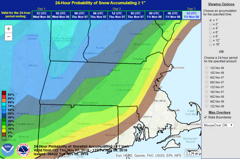
According to the National Weather Service, unless you are further inland or in higher terrain, you will likely have to wait to get any kind of snow accumulation.
From Thursday night into early Friday morning, it appears it will mainly be just a period of rain. A bit of snow is possible in the high terrain, but any accumulations will likely be minor. While changes can still occur, the odds of 1″+ of snow are rather low outside of the highest terrain of MA.
While it will be windy, it appears likely that the Fall River area will be too warm for snow.
The forecast:

Thursday
Mostly sunny, with a high near 55. Southwest wind 5 to 13 mph.
Thursday Night
Rain. Low around 41. Southwest wind 7 to 15 mph becoming northwest after midnight. Chance of precipitation is 80%.
Friday
A chance of rain before 11am. Partly sunny, with a high near 42. Breezy, with a northwest wind 10 to 15 mph increasing to 17 to 22 mph in the afternoon. Winds could gust as high as 40 mph. Chance of precipitation is 50%.
Friday Night
Mostly clear, with a low around 26. Northwest wind 13 to 16 mph, with gusts as high as 32 mph.


You must be logged in to post a comment Login