

Community
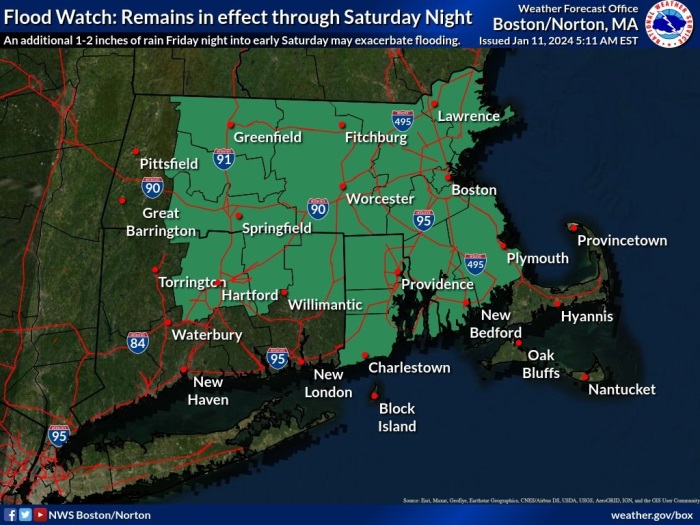
Déjà vu; Brace yourselves for new storm bringing damaging winds, flooding rain to Massachusetts, Rhode Island
BOSTON – Get ready for a déjà vu! Brace yourselves as another potent system gears up to make its mark on southern New England.
According to the National Weather Service Boston, a widespread 2 to 4 inches of rain fell Tuesday Night into Wednesday morning combined with rapid snowmelt. This resulted in numerous rivers and streams going into flood or expected to go into flood within 24 hours from the residual runoff.
In addition, another widespread 1 to 2 inches of rain is expected Friday night into early Saturday. This may exacerbate current river and stream flooding and/or result in additional flooding. Therefore, the Flood Watch has been extended through Saturday throughout southern New England.
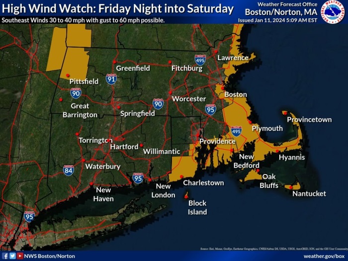

In addition to a Flood Warning and Flood Warch, a High Wind Watch is in effect from late Friday through Saturday afternoon.
Southeast winds of 30 to 40 mph with gusts up to 60 mph are possible for portions of eastern, northeastern and southeastern Massachusetts and northern and southern Rhode Island.
Damaging winds could blow down trees and power lines. Power outages are possible. Travel could be difficult, especially for high profile vehicles.


You must be logged in to post a comment Login