

Community
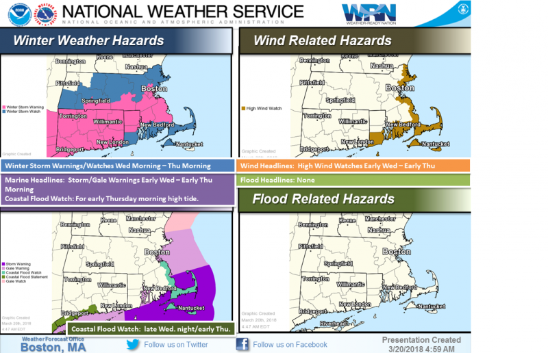
Winter Storm Watch, High Wind Watch issued ahead of storm
According to the National Weather Service, Winter Storm Warnings, Watches have been issued for the Wed-Thu storm.
According to the National Weather Service, Winter Storm Warnings, Watches have been issued for the Wed-Thu storm.
Winter Storm Watch in effect from March 21, 08:00 AM EDT until March 22, 08:00 AM EDT
High Wind Watch in effect from March 21, 08:00 AM EDT until March 22, 08:00 AM EDT

However, there remains uncertainty, which is why Watches also remain.
Winds/Coastal Flooding also still risks.
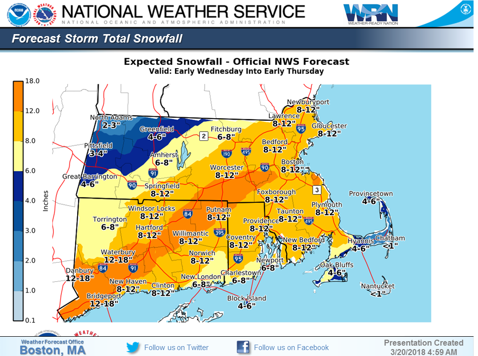
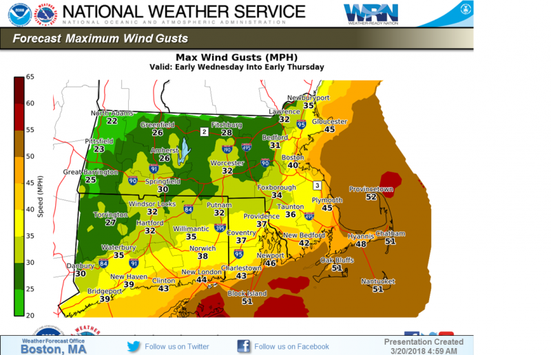
Here is the updated forecast.
Tonight
A chance of snow before 4am, then a chance of rain and snow between 4am and 5am, then a chance of snow after 5am. Cloudy, with a low around 31. Northeast wind 9 to 16 mph, with gusts as high as 34 mph. Chance of precipitation is 30%. Little or no snow accumulation expected.
Wednesday
Snow, mainly after 8am. The snow could be heavy at times. High near 35. Breezy, with a northeast wind 20 to 25 mph, with gusts as high as 39 mph. Chance of precipitation is 100%. New snow accumulation of 3 to 7 inches possible.
Wednesday Night
Snow before 11pm, then rain and snow. The snow could be heavy at times. Low around 32. Breezy, with a north wind around 22 mph, with gusts as high as 47 mph. Chance of precipitation is 100%. New snow accumulation of 3 to 5 inches possible.
Thursday
A chance of snow, mainly before 10am. Mostly cloudy, with a high near 40. North wind 14 to 17 mph, with gusts as high as 40 mph. Chance of precipitation is 30%.


You must be logged in to post a comment Login