
Community
Winter Storm Watch issued for parts of Massachusetts as strong winds, precipitation, expected this weekend
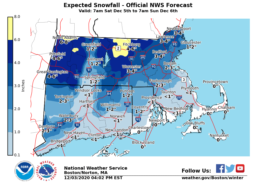
A storm is expected to be headed our way this weekend bringing snow and wind to some parts and a windy snow/rain mix to others.
According to the National Weather Service, a Winter Storm Watch is in effect for portions of interior Massachusetts from Saturday morning through Sunday morning. Heavy snow is possible, up to 6 inches or more.
The NWS is quick to point out that it is early, and placement/amounts are highly uncertain.
In southern New England, a rain and snow mix is expected with smaller accumulations of snow, if any.

The storm forecast for the southcoast:
Friday Night
A chance of rain, mainly after 8pm. Patchy fog after 5am. Otherwise, cloudy, with a low around 43. Southwest wind 5 to 9 mph becoming calm after midnight. Chance of precipitation is 50%. New precipitation amounts between a tenth and quarter of an inch possible.
Saturday
Rain before 4pm, then rain and snow likely. The rain could be heavy at times. Patchy fog before 7am. High near 44. North wind 8 to 18 mph, with gusts as high as 37 mph. Chance of precipitation is 90%.
Saturday Night
A chance of rain and snow before 7pm, then a chance of snow between 7pm and midnight. Mostly cloudy, with a low around 33. Northwest wind 15 to 18 mph, with gusts as high as 33 mph. Chance of precipitation is 50%.


You must be logged in to post a comment Login