

Community
Winter Storm Watch issued for much of the area this weekend
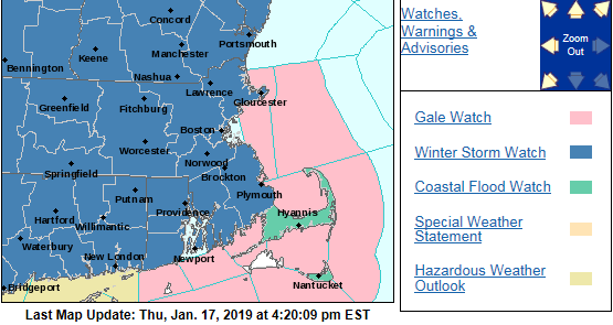
A Winter Storm Watch has been issued for much of the area ahead of this weekend’s storm.
According to the National Weather Service, the Watch will be in effect from Saturday at 4:00 p.m. to Sunday at 7:00 p.m.
Heavy snow, sleet, and freezing rain. Total snow accumulations of 6 inches or more possible with the highest risk north of the Massachusetts turnpike. Highest potential for over a foot of snow is north of route 2 in Massachusetts. In addition, ice accretion of one tenth to three tenths of an inch are possible mainly to the south of the Massachusetts turnpike with localized amounts up to one half inch possible.

Snow develops by early Saturday evening. The snow will change to sleet and freezing rain south of route 2 between midnight and 6 am Sunday. The bulk of the freezing rain and ice accretion is expected south of the Massachusetts turnpike, where some scattered power outages are possible if higher amounts occur. Precipitation may change to a period of all rain along and southeast of the Boston to Providence corridor for a time. If this occurs, rapidly falling temperatures on Sunday may result in a flash freeze. Mixed precipitation will transition back to a period of snow before ending sometime Sunday afternoon or early evening.
A Winter Storm Watch means there is potential for significant snow, sleet or ice accumulations that may impact travel.


You must be logged in to post a comment Login