

Community
Winter Storm Watch for much of the area Thursday
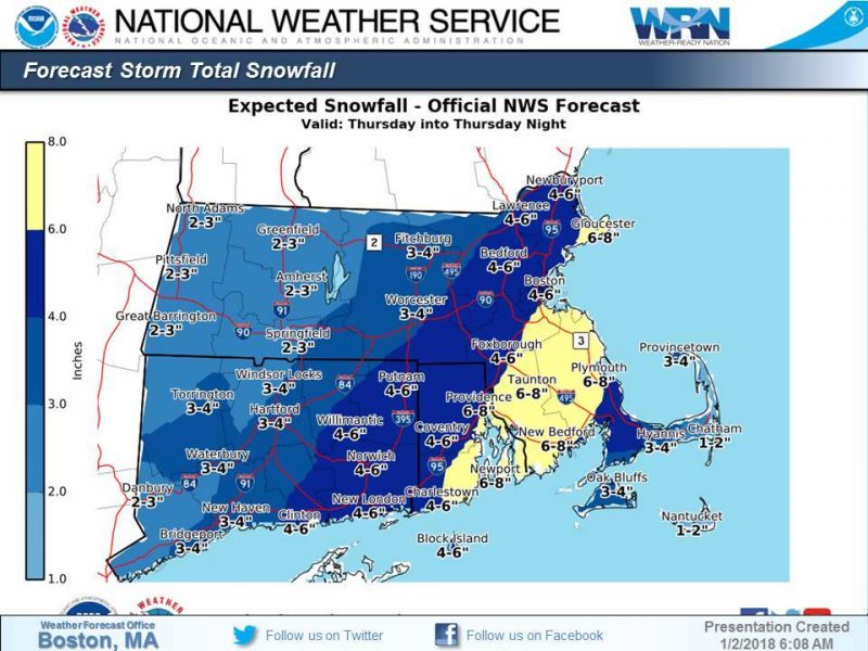
According to the National Weather Service, a strong coastal system will bring several hazards to southern New England.
According to the National Weather Service, a strong coastal system will bring several hazards to southern New England. Please keep in mind that this system is still 2 days away and there will be some changes to the forecast.
A Winter Storm Watch is currently in effect from Thursday morning into Thursday night.
Snow: Snow will move over the region Thursday morning lasting into the evening hours. Expect highest totals across RI and eastern MA where a winter storm watch has been issued. The evening commute on Thursday looks to be most impacted.

Strong winds: Strength of the upcoming system will result in strong, damaging wind gusts especially across the Cape and the Islands. This could result in some power outages. There is the potential that forecast wind gusts could be increased if the storm trends closer to SNE.
Coastal Flooding: A storm surge of 2-3 feet will lead to minor to moderate coastal flooding for the eastern MA coastline for the Thursday mid-day high tide.


You must be logged in to post a comment Login