
Community
Strong winds and colder temperatures bringing below zero wind chills to New England
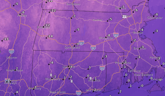
Remember when it felt like spring just a few days ago? Strong winds and colder temperatures will bring wind chills to the area that are below zero.
According to the National Weather Service, a Wind Advisory for most of Southern New England has been issued until midnight tonight.
Northwest winds 20 to 30 mph with gusts of up to 50 mph are expected.
Gusty winds could blow around unsecured objects. Tree limbs could be blown down and a few power outages may result.
The NWS warns to use extra caution when driving, especially if operating a high profile vehicle and to secure outdoor objects.

The strong winds and cold temps will bring below zero wind chills on Monday morning and high temperatures in the upper 20s. On the bright side, it should be a sunny day.
The National Weather Service in Boston/Norton has also issued a Red Flag Warning due to the combination of gusty northwest winds and very low relative humidity, which is in effect until 8:00 p.m. Sunday.
Dry and windy conditions turn car fire into highway brush fire
A Red Flag Warning means that critical fire weather conditions are expected. Any fires that start may spread rapidly and become difficult to extinguish.


You must be logged in to post a comment Login