

Community
Soaking rain, wind forecast this weekend over much of the area
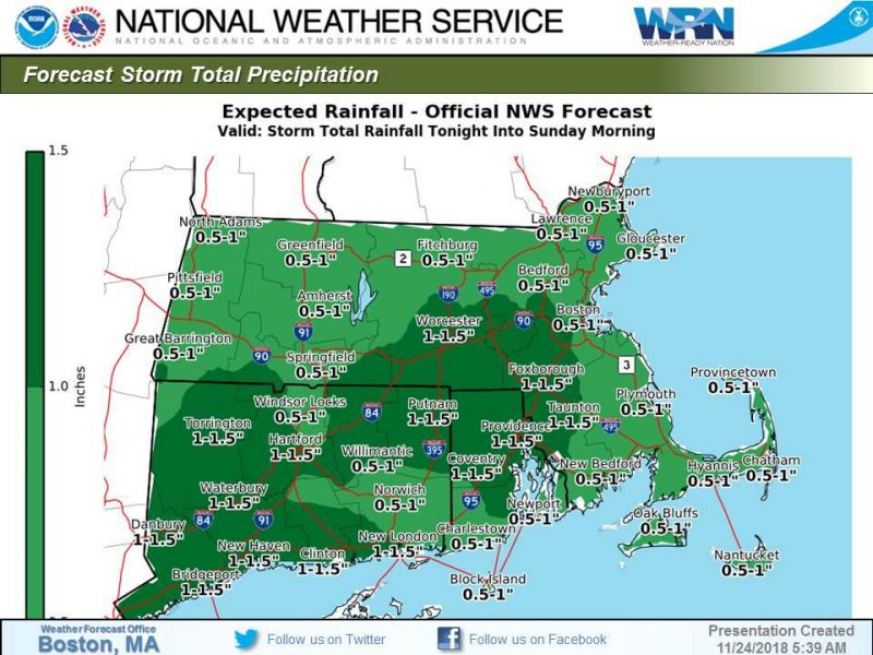
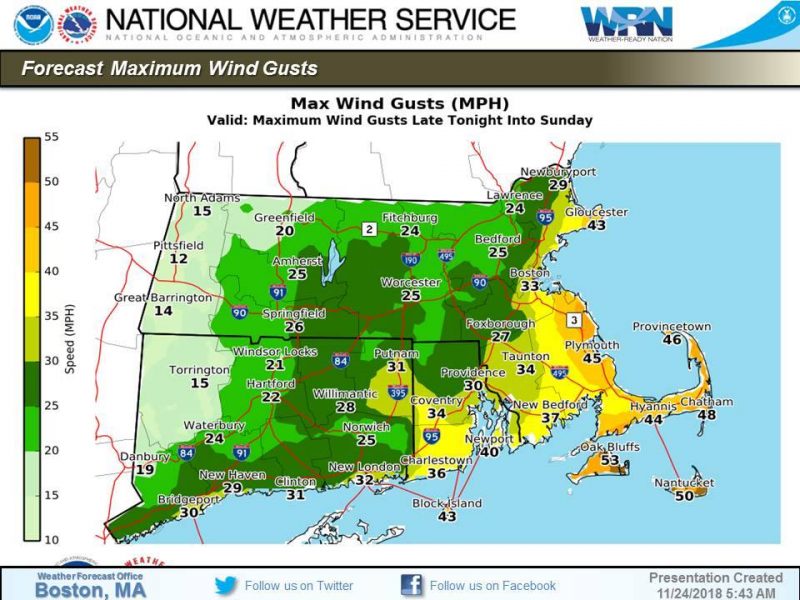
The National Weather Service is predicting wind and heavy rain across the area this weekend.
A soaking rain will ovespread the region tonight. There is a low risk that the rain begins as a period of freezing rain across far western into north central Massachusetts between 8 pm and midnight this evening. Any icing would be light, but it only takes a small
amount of freezing rain to result in hazardous travel.
Poor drainage street flooding along with some minor river/stream flooding is possible. Minor coastal flooding is expected during Sunday midday high tide along the eastern MA coast.
Tonight
Rain, mainly after 1am. The rain could be heavy at times. Patchy fog after midnight. Low around 38. Light east wind increasing to 5 to 10 mph in the evening. Winds could gust as high as 22 mph. Chance of precipitation is 100%. New precipitation amounts between a half and three quarters of an inch possible.
Sunday
Rain likely, mainly before 1pm. Patchy fog before 3pm. Otherwise, cloudy, with a high near 47. North wind 8 to 13 mph, with gusts as high as 32 mph. Chance of precipitation is 70%. New precipitation amounts between a quarter and half of an inch possible.

Sunday Night
A chance of showers, mainly after 4am. Mostly cloudy, with a low around 36. Northwest wind 5 to 7 mph becoming calm in the evening. Chance of precipitation is 30%. New precipitation amounts of less than a tenth of an inch possible.
Monday
Rain likely, mainly after noon. Cloudy, with a high near 47. Southeast wind 3 to 7 mph. Winds could gust as high as 21 mph. Chance of precipitation is 70%.
Monday Night
Rain, mainly before midnight. Low around 34. Chance of precipitation is 90%.


You must be logged in to post a comment Login