

Community
Snow forecast brings Winter Storm Warning to area
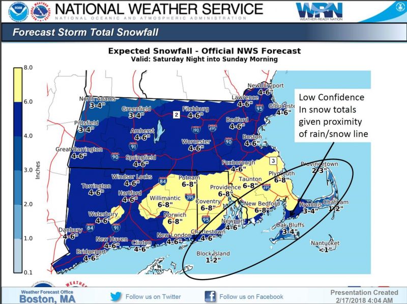
The heaviest snow will occur along and to the south of the Massachusetts Turnpike and north of Cape Cod
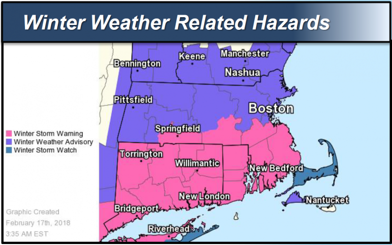
The entire state is under a Winter Storm Warning, Watch or Advisory from 7 PM tonight to 7 AM tomorrow morning. Snow will overspread the state between 6 PM and 9 PM this evening and end between 5 AM and 7 AM on Sunday morning.
The Fall River area is in a Winter Storm Warning from 7 PM this evening to 7 AM Sunday.
The heaviest snow will occur along and to the south of the Massachusetts Turnpike and north of Cape Cod where 6” to 8” is possible. Snowfall rates of 1” to 2” per hour are possible at times between 10 PM and 4 AM.
To the north of the Massachusetts Turnpike, the forecast calls for 4” to 6” of snow.
1” to 4” of snow is forecast for the Cape and Islands where snow may mix with rain for a period of time.

There is some uncertainty as to where the road/snow line may set up. If the storm tracks closer to the coast than expected, higher snowfall amounts would occur north of the Turnpike, and totals would be lower near the south coast where more rain would mix in with the snow. If the storm tracks further southeast, snowfall totals would be lower than forecast for most of the region, except across the Cape and Islands where colder temperatures would support more snow.
Travel may be hazardous for a period of time during the late evening and overnight hours. The snow will end around daybreak on Sunday and temperatures will quickly rise above freezing.
There is a low risk for isolated power outages, particularly in areas that receive 6” or more snow, or along the south coast where the snow may be wet and heavy.


You must be logged in to post a comment Login