Community
Snow and gusty winds forecast for Wednesday/Thursday

The National Weather Service is predicting gusty winds and snow Wednesday and Thursday.
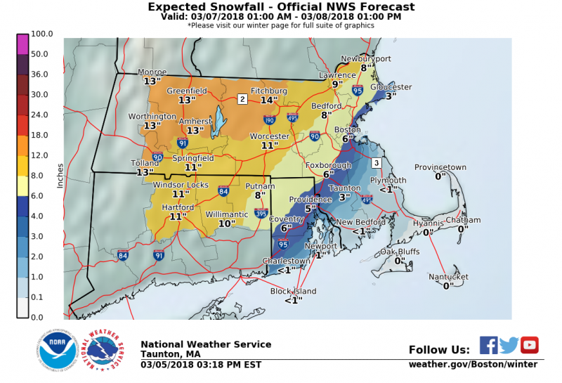
Snow arrives Wednesday morning in western New England and reaches the East Coast during the afternoon. The most snow is expected across the interior, where as much as 12-16″ of snow could fall in parts of western Massachusetts. Closer to the coast, there is still uncertainty as to where the rain/snow line will be, so our confidence is lower in these projected totals.
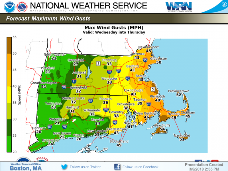
Strong winds are expected along the eastern Massachusetts coast where gusts could reach 60 mph. Although astronomical tides are much lower than the past weekend, minor coastal flooding is possible with the early Thursday morning high tide.
Finally, if snow does change to rain Wednesday afternoon and evening in Rhode Island and eastern Massachusetts, flooding of rivers, streams, and urban areas would become a concern.


You must be logged in to post a comment Login