

Community
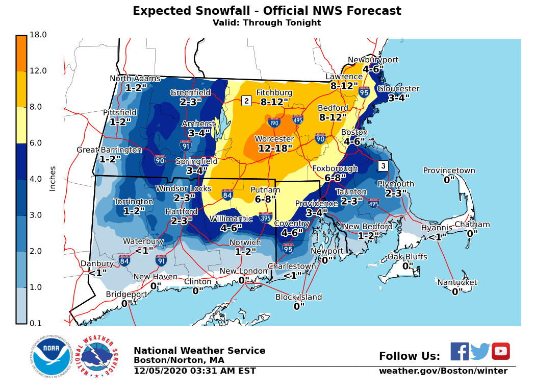
Parts of Massachusetts to see up to 18 inches of snow and winds up to 65 mph Saturday
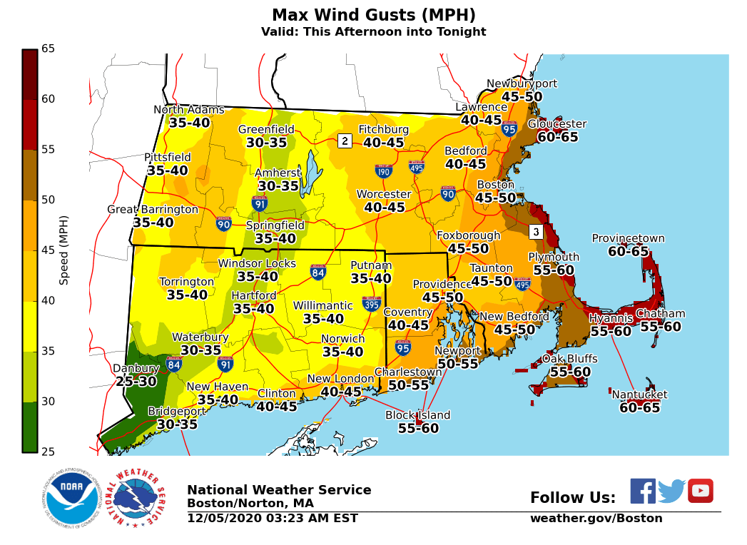
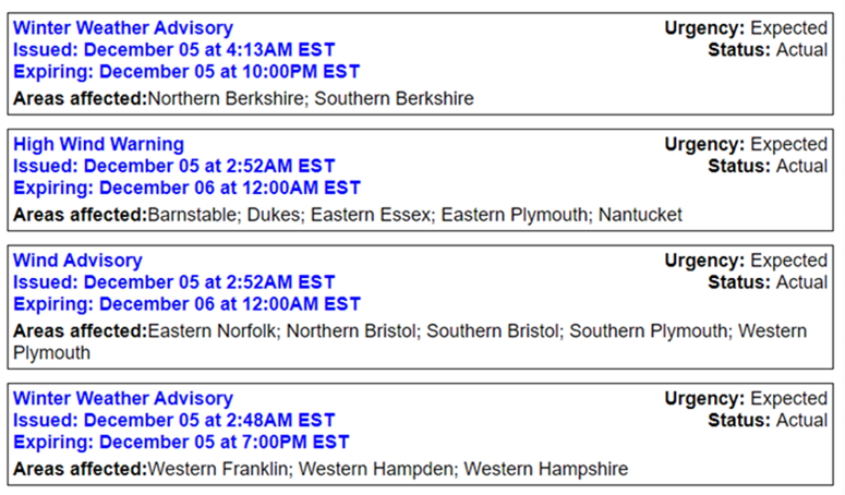
Today through early Sunday a strong winter storm will bring heavy rain changing over in the afternoon to a period of heavy wet snow across the interior along with strong wind gusts of 50- 60 mph along the coast. Wind gusts are expected to increase this afternoon and taper off late tonight.
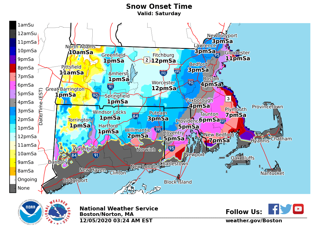
The current forecast predicts the axis of heaviest snowfall to be in central Massachusetts, with up to 8-14 inches of snow possible in isolated and higher-elevation areas. Snow will begin in the afternoon and will taper off from west to east and end statewide by early Sunday morning. Sunday is anticipated to be a dry weather day.

The National Weather Service is most confident in snowfall totals and potential for power outages in central and northeast MA. Lower confidence in snowfall amounts in western MA along the western edge of the heavier precipitation, and along the I-95 corridor due to the timing of the changeover.
Impacts:
Wet, heavy snow may lead to tree/wire damage and power outages, especially in central and northeast MA.
Wind gusts of 50-60 mph may result in downed trees/wires and power outages from Cape Ann to Plymouth County, and Cape Cod/Islands.
Areas of urban and poor drainage street flooding possible across southeast MA.
Strong winds are expected along the coast, including rough seas and coastal waters.
Low visibility will create travel impacts, particularly late afternoon when the rate of snowfall could be 1 inch per hour or greater.


You must be logged in to post a comment Login