

Community
Heavy rain, thunderstorms possible across southern New England
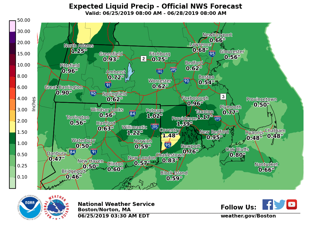
Some storms with heavy rain are possible today according to the National Weather Service.
Showers and scattered thunderstorms may produce locally heavy rainfall this afternoon into early this evening, which could cause local urban and poor drainage flooding. The best chance for any localized flooding may occur across eastern Connecticut, Rhode Island into southeastern Massachusetts.
Localized heavy rainfall with amounts of 2+ inches in a 6-hour period are possible. Urban and poor drainage flooding are possible if these amounts are realized.

The forecast:
Today
Showers likely, then showers and possibly a thunderstorm after 2pm. Some of the storms could produce heavy rainfall. Patchy fog between 1pm and 2pm. South wind 5 to 9 mph. New rainfall amounts between three quarters and one inch possible.
Tonight
Showers and possibly a thunderstorm before midnight, then a slight chance of showers between midnight and 2am. Some of the storms could produce heavy rainfall. Patchy fog. South wind 5 to 7 mph becoming light and variable after midnight. New precipitation amounts between a quarter and half of an inch possible.


You must be logged in to post a comment Login