

Community
Complicated storm to bring high elevation icing and wintry mix
The National Weather Service (NWS) is forecasting a complicated storm system bringing concerns for significant higher-elevation icing and wintry mix of precipitation types for Southern New England tonight into Tuesday.
Tonight into Monday:
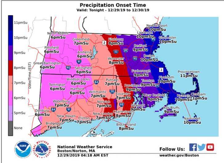
Significant icing developing in higher elevations in western MA (eastern slopes of the Berkshires) and north-central MA (Worcester County hills into northwest Middlesex County) tonight through Monday night. Icing is expected to begin tonight and continue into Monday evening, with temperatures around 30 degrees.
High confidence in icing accumulations of a half-inch or greater in each area, with local amounts up to one inch possible in the eastern slopes of the Berkshires where freezing rain is expected to predominate.
Lower elevations will experience lesser amounts of sleet and freezing rain that will develop tonight and continue through Monday.
Accumulations of freezing rain and sleet will affect the Monday morning commute. While freezing rain is still expected to continue across interior MA for the afternoon commute, a wintry mix of sleet to rain is expected towards the MA East coast.
Icing amounts range from a light glaze to a quarter-inch, though may locally be near a half-inch in spots N/W of I-84 and I-495 if freezing rain can remain more prolonged.
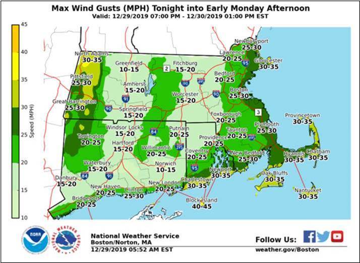
Onset, peak wind gusts tonight into Monday afternoon (e.g. period when icing is greatest), and peak wind gusts for Monday evening.

Monday into Tuesday:
A brief period of snow is possible at the end of the storm late Monday night into Tuesday, especially in northern Massachusetts near the New Hampshire border. Up to a couple inches of snow is expected in these areas.
Storm Confidence:
The NWS has high confidence that this storm system will occur and produce a wintry mix. Confidence has also increased on the potential for significant icing and impact in higher-elevation areas (e.g. those areas currently in Ice Storm and Winter Storm Warnings).
Confidence on the distribution/duration of precipitation types is moderate outside of the two Ice Storm and Winter Storm Warning areas. This may result in further significant change in snow/sleet and ice accumulations – especially across northeast MA, and southern interior MA.
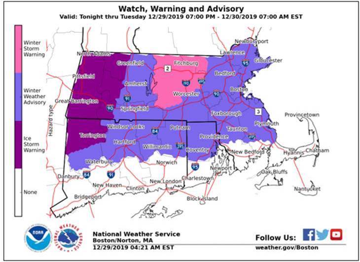
Advisories, Watches and Warnings
Ice Storm Warnings for the eastern slopes of the Berkshires. Predominantly freezing rain of a prolonged-duration is expected here, with the most significant icing and impacts expected for these locations.
Winter Storm Warning for northern Worcester County into northwest Middlesex County in MA. Wintry mixture of freezing rain and sleet here, though greatest impact from freezing rain. Significant icing and impacts expected.
Winter Weather Advisories for most of the remainder of Southern New England (except southern Plymouth & Bristol Counties in MA into Cape Cod and the Islands). Mix of precipitation types for these areas, with lesser though still impactful accretions of freezing rain and sleet; with snow possible northern MA.


You must be logged in to post a comment Login