

Community
Area to see some of the coldest weather we have seen in over a year, big storm ahead?
We have had a mild winter by all accounts, however, a cold snap that occurred this past weekend is expected to be topped later this week.
This past weekend, a Hazardous Weather Outlook was issued by the National Weather Service for eastern Massachusetts, northeastern Massachusetts, southeastern Massachusetts, northern Rhode Island and southern Rhode Island as wind chill feel like temperatures went below zero in many communities.
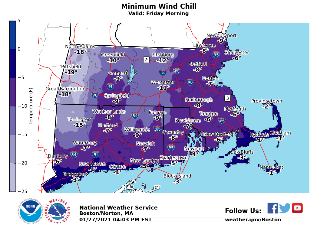
According to the National Weather Service, a bitter cold airmass will be moving in late Thursday night into Friday on gusty northwest winds. Widespread subzero wind chills are expected by Friday morning which will be some of the coldest feel like temperatures we have seen for some time.
We could also see a dusting of snow on Thursday morning.
Much has also been said about a possible big snowstorm or snow/rain mix at the beginning of next week, however, the NWS is stating that it is much too early to get a reliable forecast when the possible system is 5 days out.
The forecast:

Thursday
A chance of snow showers, mainly before 11am. Cloudy, with a high near 34. North wind 7 to 11 mph. Chance of precipitation is 30%. Little or no snow accumulation expected.
Thursday Night
Mostly clear, with a low around 10. Wind chill values as low as -2. Northwest wind around 14 mph, with gusts as high as 28 mph.
Friday
A slight chance of snow showers between 10am and 11am. Mostly sunny, with a high near 20. Wind chill values as low as -6. Northwest wind 15 to 17 mph, with gusts as high as 31 mph. Chance of precipitation is 20%.
Friday Night
Mostly clear, with a low around 10. Northwest wind 9 to 14 mph, with gusts as high as 26 mph.
Saturday
Sunny, with a high near 24. Northwest wind around 10 mph.
Saturday Night
Mostly clear, with a low around 11. Northwest wind 5 to 7 mph.


You must be logged in to post a comment Login