

Community
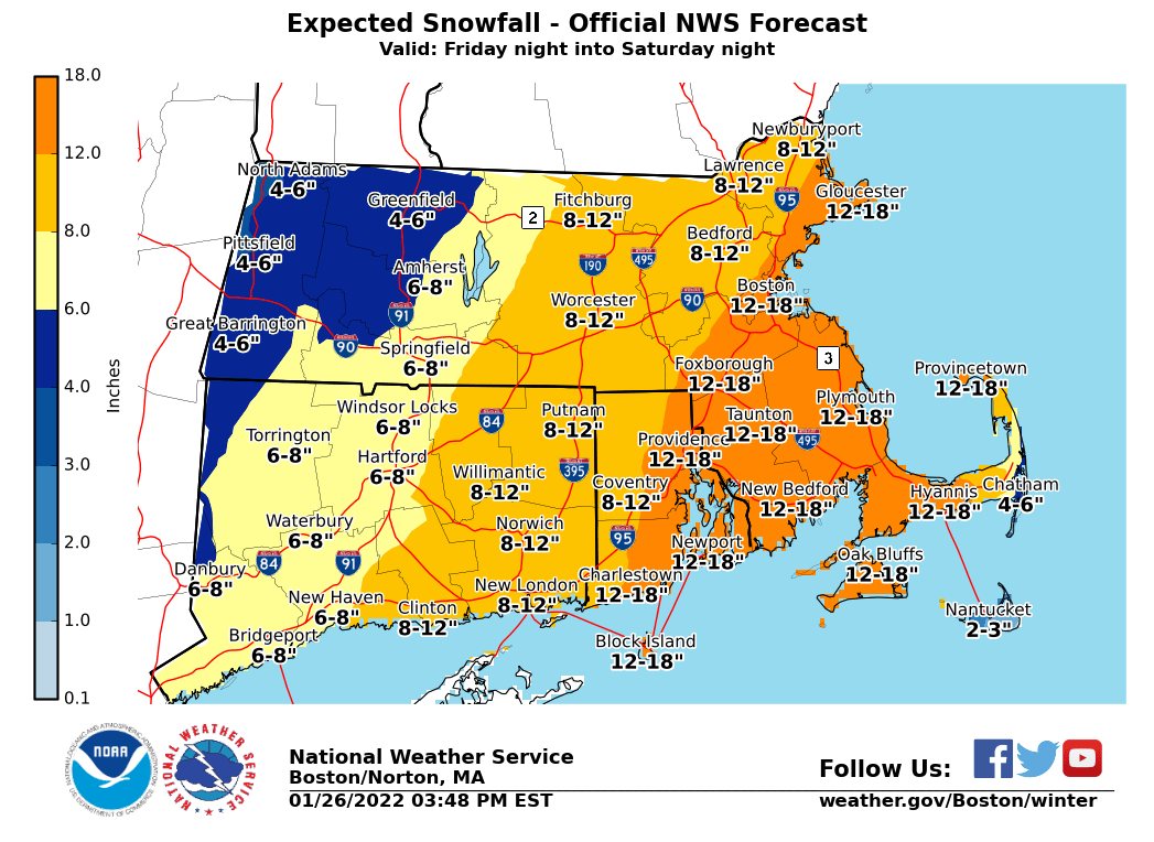
Winter Storm Watch issued as Fall River to Boston could see up to a foot and a half of snow, damaging winds
Confidence is increasing that a significant winter storm will create considerable impacts Friday through the weekend from the Mid-Atlantic through the Northeast.
A Winter Storm Watch has been issued for portions of eastern, northeastern and southeastern Massachusetts and northern and southern Rhode Island. From late Friday night through Saturday evening.
According to the National Weather Service, heavy snow is possible with total snow accumulations of 8 to 16 inches possible. Winds could gust as high as 60 mph, especially on Cape Cod.
Significant coastal impacts are possible in the Northeast, including coastal flooding and beach erosion. Additionally, strong winds may cause blowing snow and some damage.

Hazardous travel conditions are likely in parts of the region.
Heavy snow is still possible farther south along the East Coast, including the major I-95 metro areas from New York City to Washington D.C., but that is more uncertain at this time.
Travel could be very difficult to impossible during the storm. Strong winds could cause tree damage.
There is still uncertainty regarding the track of the storm. The axis of heaviest snowfall may shift with later forecasts.


You must be logged in to post a comment Login