
Community
Winter Storm Warning issued for southeastern Massachusetts and Rhode Island as nor’easter details refined ahead of storm
As a major storm is expected to be headed our way, the forecast has become more refined.
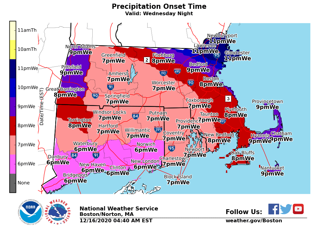
A Winter Storm Warning has been issued this morning by the National Weather Service for portions of southeastern Massachusetts and northern and southern Rhode Island from 7 PM this evening to 1 PM EST Thursday.
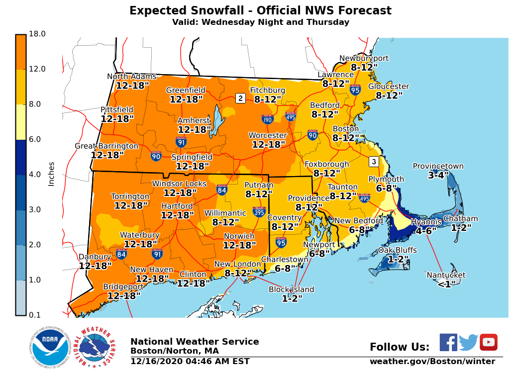
Heavy snow is expected. Total snow accumulations of 6 to 11 inches. Winds gusting as high as 45 mph.
Travel could be very difficult to impossible. The hazardous conditions could impact overnight travel as well as the Thursday morning commute. Gusty winds could bring down tree
branches.
Snow develops tonight, becoming heavy at times overnight into early Thursday. A brief period of above- freezing temperatures early Thursday morning will cool rapidly by mid to late morning, with a rapid freeze-up of roads. Snow ends by Thursday afternoon.

NWS recommends that if you must travel, keep an extra flashlight, food, and water in your vehicle in case of an emergency.
Snow arrives from southwest to northeast during the early evening. Road conditions will deteriorate quickly due to snowfall rates 1-2″ per hour.
The forecast:
Tonight
Snow before 4am, then snow and sleet. The snow could be heavy at times. Patchy fog after 4am. Patchy freezing fog before 4am. Low around 28. Blustery, with a northeast wind 10 to 15 mph increasing to 16 to 21 mph after midnight. Winds could gust as high as 31 mph.
Thursday
Snow, mainly before 1pm. Patchy fog. Temperature falling to around 23 by 1pm. Breezy, with a north wind 15 to 22 mph, with gusts as high as 32 mph.


You must be logged in to post a comment Login