

Community
While we clean up Saturday storm, more snow headed our way
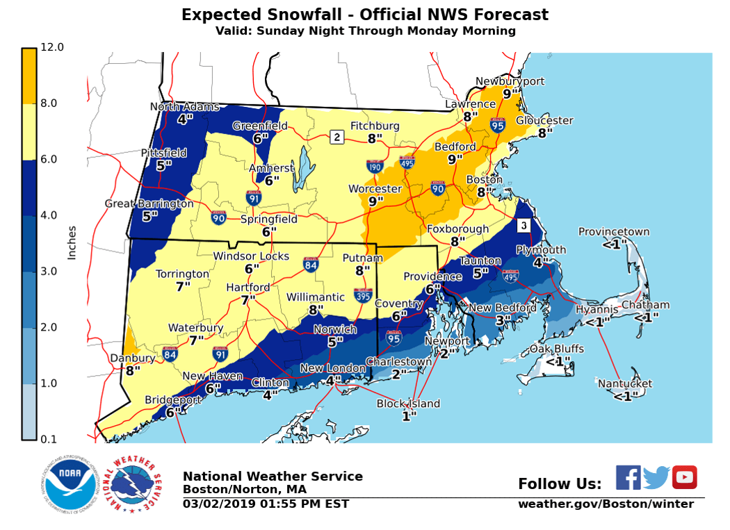
While today’s snow storm has tapered off, more snow and precipitation is headed our way Sunday into Monday.
The National Weather Service has issued an update on the Sunday to Monday storm.
A Winter Storm Watch has been issued for all except coastal areas.
Sunday Evening/Mid Monday Morning:

What:
-Accumulation of 6 to 12 inches possible north and west of the Boston-Providence corridor. Lesser amounts to the south and east.
-Impacts to the Monday morning commute especially across the interior.
-Risk for isolated to scattered power outages from northern CT into northwest RI and interior MA if higher snow amounts are realized.
Where:
-Greatest risk for significant snow will be northwest of the Boston to Providence corridor, but significant snow is still possible in the Boston to Providence corridor depending on the exact track.
When:
-Snow develops between 5 and 8 pm Sunday evening and will be heavy at times during the overnight hours.
-Snow may change to rain across portions of coastal and southeastern MA and RI depending on the exact track.
-Precipitation tapers off by mid morning Monday
Uncertainty:
-Forecast models have moved closer to each other and favor a storm passing off the coast. There remains some uncertainty on placement of the rain-snow line as the forecast tracks shift, but less uncertainty than in previous forecasts.


You must be logged in to post a comment Login