

Community
While some details remain uncertain, National Weather Service Boston issues storm update
The new updated forecast on this weekend’s impending storm has been released with some details remaining unclear.
According to the National Weather Service in Boston, a winter storm watch is in effect from Saturday evening through Sunday night for communities north and west of Fall River.
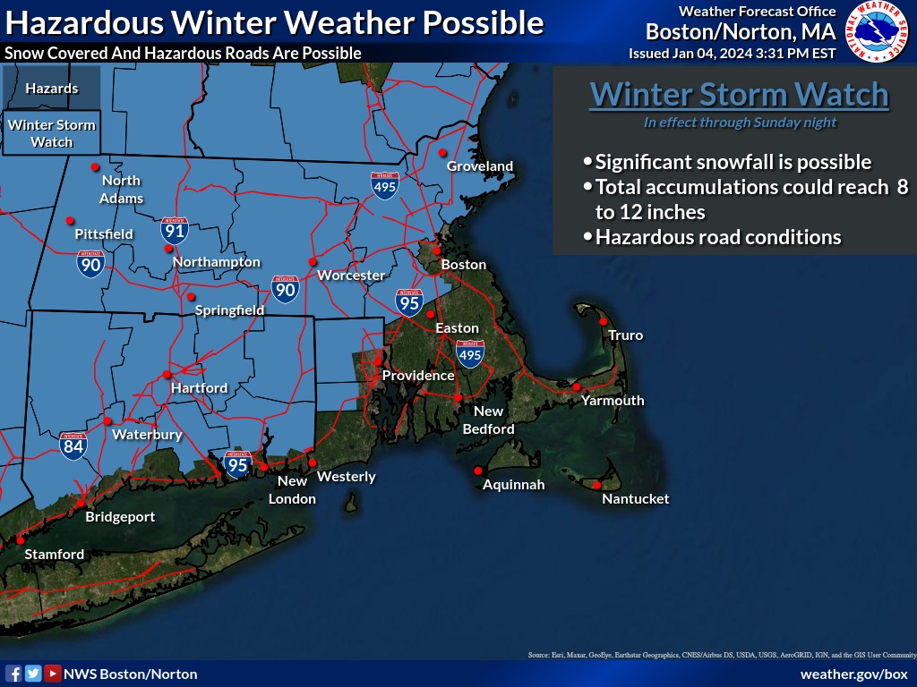
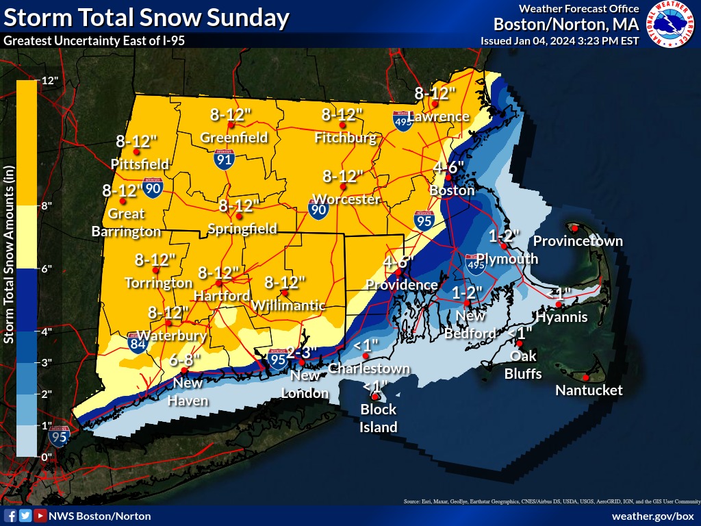
Heavy snow accumulations of 8-12 inches are possible for areas north and west of I-95.
Areas east of I-95, snow totals are less certain and will depend on where the rain/snow line sets up.

The forecast:
Saturday Night: Rain, possibly mixed with snow, becoming all rain after 5am. Low around 31. East wind 6 to 11 mph increasing to 13 to 18 mph after midnight. Chance of precipitation is 100%.
Sunday: Snow, possibly mixed with rain, becoming all snow after 3pm. High near 38. Windy, with a northeast wind around 26 mph becoming north in the afternoon. Winds could gust as high as 39 mph. Chance of precipitation is 90%.
Sunday Night: A chance of snow before 9pm. Mostly cloudy, with a low around 22. Blustery, with a northwest wind 18 to 23 mph decreasing to 9 to 14 mph after midnight. Winds could gust as high as 34 mph. Chance of precipitation is 40%.


You must be logged in to post a comment Login