

Community
Thursday storm update continues track of high snow and winds
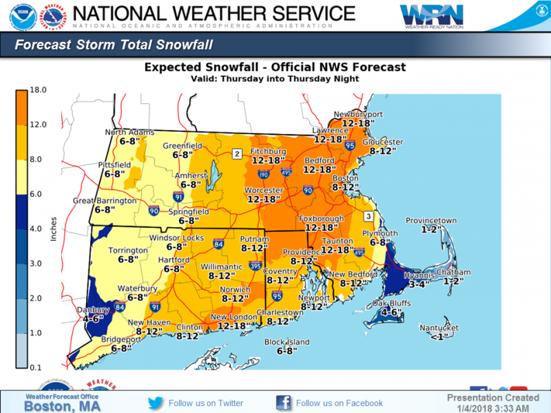
Heavy snow will reach southern New England this morning from south to north. Expect difficult, if not impossible, travel conditions from later this morning through the afternoon. In far southeast Massachusetts, including Cape Cod and the Islands, rain will quickly change to snow during the afternoon. Please stay off the roads today if at all possible.
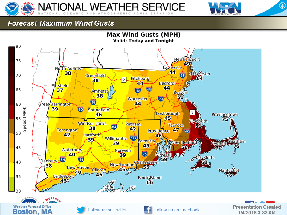
Strong northerly winds will gust as high as 40-50 mph across much of the area, except as high as 65 to 75 mph along the immediate coast of eastern Massachusetts and Cape Cod and the Islands where wind damage and power outages are more likely to occur.
Moderate to major coastal flooding is expected along the eastern Massachusetts coast during today’s midday high tide. The worst of the flooding will be to the south of Boston, especially in coastal Plymouth County and from Sandwich to Dennis on Cape Cod.

Behind this storm, another surge of bitterly cold air will arrive Friday into Saturday. Wind chills could fall to between 15 below and 35 below zero.


You must be logged in to post a comment Login