
Community
Strong to severe thunderstorms possible Tuesday afternoon and evening
The National Weather Service forecast offices in Norton and Albany have issued a warning concerning the potential for strong to severe thunderstorms Tuesday afternoon and evening.
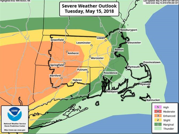
The National Weather Service forecast offices in Norton and Albany have issued a warning concerning the potential for strong to severe thunderstorms Tuesday afternoon and evening.
From the National Weather Service in Norton (for all of MA except Berkshire County):
The threat for strong to severe storms remains across interior southern New England this afternoon and evening.
What – Scattered severe thunderstorms with the main threat being damaging straight line wind gusts.

When – Between 2 and 9 pm this afternoon and evening. There could be a few isolated thunderstorms between 2-4 pm, but appears the main line of severe weather will move into the region around 4-5pm.
Where – Highest risk for severe thunderstorms is across western/central MA and northern CT, but can not be ruled out across the rest of the region including the near shore waters.
Uncertainty:
- It is possible that we see a decent area of straight line wind damage in portions of western/central MA and into northern CT.
- It is also possible that the bulk of the severe thunderstorms may shift a bit to our southwest, but northern CT still looks like it could be impacted.
- Cannot rule out the potential for an isolated tornado across the interior.


You must be logged in to post a comment Login