

Community
Strong storms possible with risk for localized flooding and strong winds
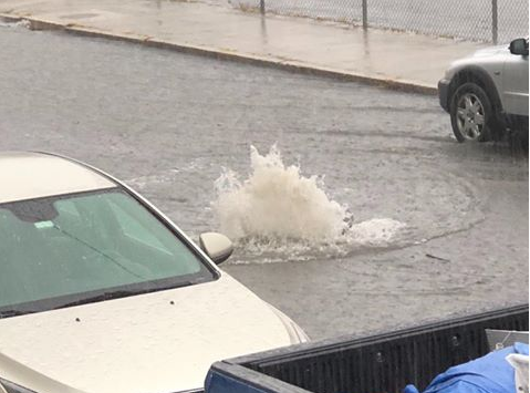
The National Weather Service is warning the area of the potential for strong storms today.
A cold front will move into southern New England this afternoon bringing a line of strong to severe storms with the potential for frequent lightning, localized heavy downpours, flooding, and damaging wind gusts. Keep in mind not every location will be impacted. Storms may not reach the south coast of MA and RI until late in the day /early evening, but those that are impacted by the strongest storms could see significant impacts.
The forecast:

This afternoon scattered showers and thunderstorms, mainly after 3pm. Some of the storms could produce heavy rain. Mostly sunny. Southwest wind 8 to 10 mph, with gusts as high as 21 mph. Chance of precipitation is 30%. New rainfall amounts of less than a tenth of an inch, except higher amounts possible in thunderstorms.
Tonight scattered showers and thunderstorms, mainly before 4am. Some of the storms could produce heavy rain. Areas of fog after 2am. Otherwise, cloudy. Southwest wind around 6 mph becoming calm in the evening. Chance of precipitation is 50%. New rainfall amounts between a quarter and half of an inch possible.


You must be logged in to post a comment Login