

Community
Storm and Wind Watches issued ahead of soaking rain
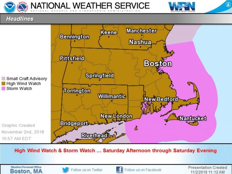
The National Weather Service has issued High Wind and Storm Watches ahead of this weekend’s rain event.
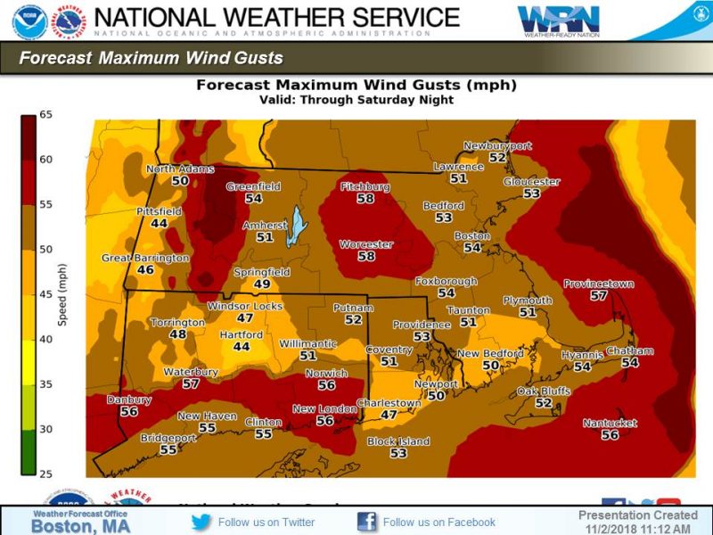
According to the NWS, through Saturday night the biggest concern is strong to damaging winds; worst will be midday Saturday – Saturday evening; High Wind Watches for all of Southern New England, Storm Watches for the waters; expect loose objects will become airborne; scattered tree damage, isolated power outages. Wind gusts will be up to 60 mph
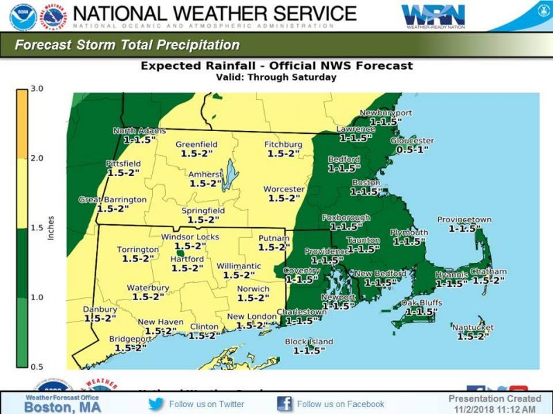
Through early Saturday a threat of heavy rain w/ isolated flooding continues, however areas of heaviest rain & highest rainfall totals remain uncertain. A widespread rainfall of 1-3″ is forecast. Hazardous travel conditions w/ water ponding on roads. No flood headlines at this time.

While the strong to severe thunderstorm risk is low, there is still the potential that the storms could produce strong to damaging winds, along with a lower risk of an isolated tornado according to NOAA NWS Storm Prediction Center.
Storm Watches over all waters off MA / RI; beginning midday Saturday thru Saturday evening expect the possibility of storm force gusts up to 50 kts; seas building as high as 20 feet; hazardous conditions for all vessels.


You must be logged in to post a comment Login