

Community
Southern New England issued Flood Watch Saturday as damaging wind gusts, flooding rains expected
BOSTON – A Flood Watch has been expanded across southern New England as heavy rains and strong wind gusts are expected in the coming days.
The National Weather Service in Norton has expanded the Flood Watch Saturday to include portions of Massachusetts and Rhode Island, including the following areas, in Massachusetts, Central Middlesex MA, Eastern Essex MA, Eastern Norfolk MA, Eastern Plymouth MA, Northern Bristol MA, Southeast Middlesex MA, Southern Bristol MA, Southern Plymouth MA, Suffolk MA, Western Essex MA, Western Norfolk MA, and Western Plymouth MA. In Rhode Island, Bristol RI, Eastern Kent RI, Newport RI, Northwest Providence RI, Southeast Providence RI, Washington RI, and Western Kent RI from Sunday afternoon through Monday evening.
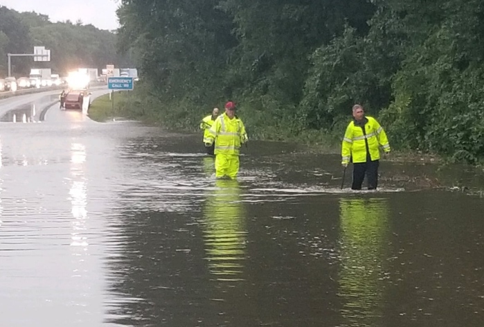
Excessive runoff may result in flooding of rivers, creeks, streams, and other low-lying and flood-prone locations. Creeks and streams may rise out of their banks. Flooding may occur in poor drainage and urban areas. Storm drains and ditches may become clogged with debris.
Multi-hazardous system Sunday night into Monday is expected to bring damaging wind gusts, flooding rains, coastal flooding concerns, in addition to dangerous marine conditions.

The first half of Sunday will be a transition period, largely dry, but a few spot showers may develop. Winds begin to uptick during this time, generally between 15-25 MPH, stronger winds arrive overnight. Afternoon highs climb to the upper-50s and low-60s. The time between mid to late afternoon conditions begin to go downhill.
Confidence remains high for strong to damaging wind across southern New England for Sunday night through Monday morning. A `High Wind Watch` continues for Cape Cod and the Islands, including the Elizabeth Islands and Block Island. Wind gusts could reach nearly 60 mph over the Cape and Islands.
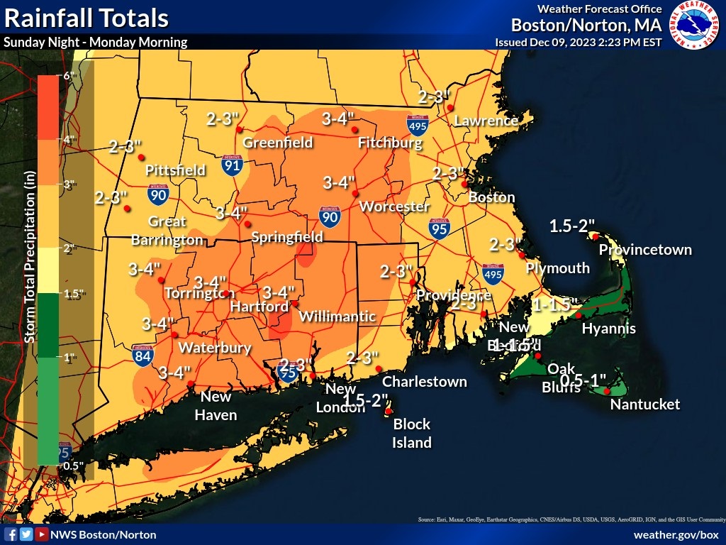
Rain total amounts between 1 and 2 inches are expected, with the greatest amounts shifting east towards eastern Connecticut, central Massachusetts, and Rhode Island. Rainfall could exceed 4 inches from southern Hartford County and northeast to southern Worcester County.


You must be logged in to post a comment Login