

Community
Southern New England could see over a foot of snow this weekend
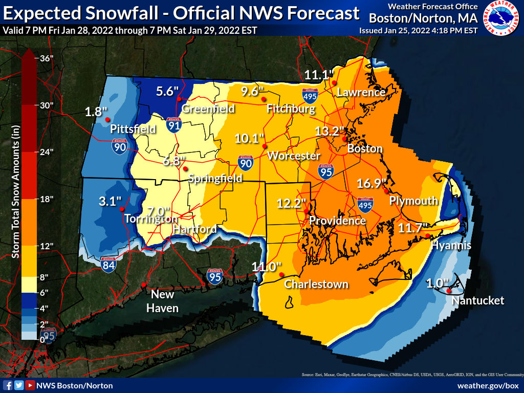
Significant wintry precipitation is possible for the East Coast this weekend.
According to the National Weather Service, confidence is increasing that a significant winter storm will create considerable impacts Friday through the weekend from the Mid-Atlantic through the Northeast.
Heavy snow is most likely in parts of New England. Heavy snow is still possible farther south along the East Coast, including the major I-95 metro areas from New York City to Washington D.C., but that is more uncertain at this time.
Significant coastal impacts are possible in the Northeast, including coastal flooding and beach erosion. Additionally, strong winds may cause blowing snow and some damage.
Hazardous travel conditions are likely in parts of the region.
A lot can change between now and then. However, the potential exists for an impactful winter storm Friday night into Saturday.

The snow forecast:
Friday
A slight chance of snow after 1pm. Cloudy, with a high near 36. Southwest wind around 6 mph becoming calm in the afternoon. Chance of precipitation is 20%.
Friday Night
Snow likely, mainly after 11pm. Cloudy, with a low around 23. Light north wind increasing to 5 to 10 mph after midnight. Chance of precipitation is 70%.
Saturday
Snow likely. Cloudy, with a high near 29. Blustery, with a north wind 15 to 21 mph, with gusts as high as 44 mph. Chance of precipitation is 70%.
Saturday Night
Snow likely, mainly before 8pm. Cloudy, with a low around 12. Northwest wind 15 to 17 mph, with gusts as high as 43 mph. Chance of precipitation is 60%


You must be logged in to post a comment Login