

Community
Some snow, a lot of damaging winds expected as area to be under High Wind Watch
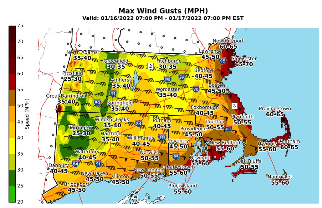
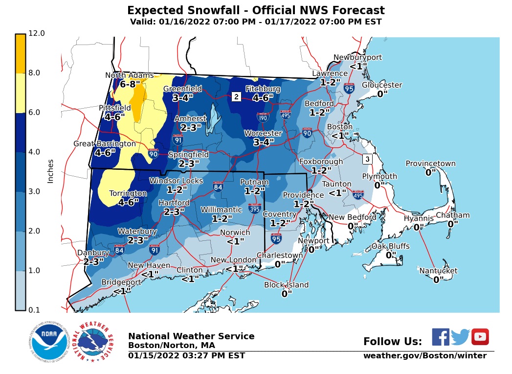
Here’s the latest look at expected snowfall totals and wind gusts with the upcoming storm Sunday night into early Monday.
According to the National Weather Service, most locations will have changed over to rain by sunrise on Monday, however the area is still expected to see accumulating snow.
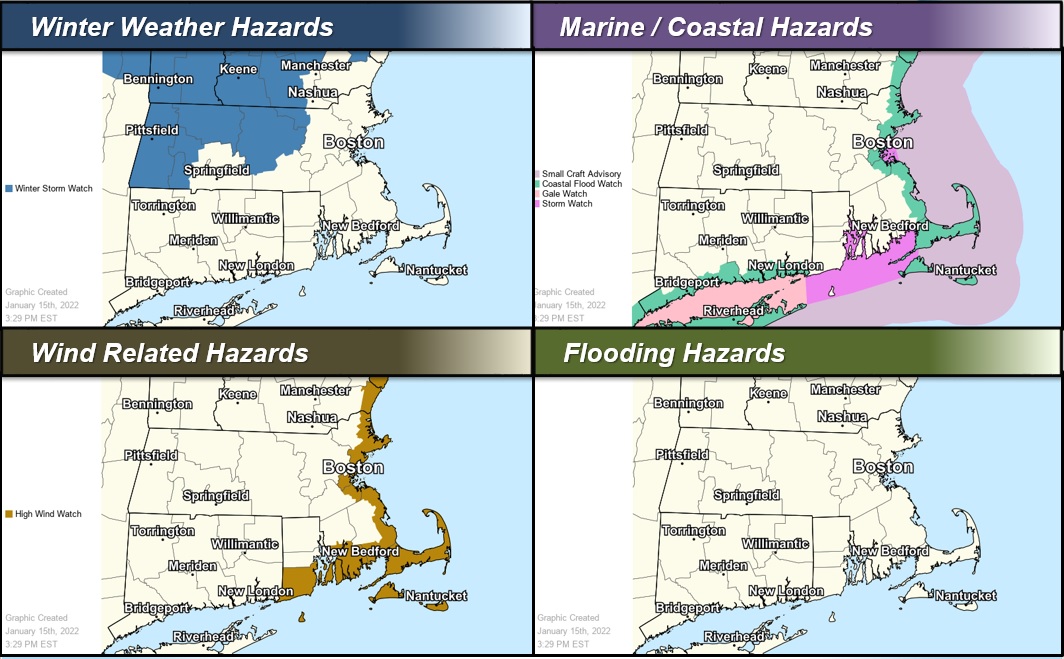
A High Wind Watch will be in place for portions of eastern, northeastern and southeastern Massachusetts and southern Rhode Island from late Sunday night through Monday morning.

Southeast winds 25 to 35 mph with gusts up to 65 mph are possible. Highest winds will take place from outer Cape Cod to Cape Ann.
Damaging winds could blow down trees and power lines. Power outages are possible. Travel could be difficult, especially for high profile vehicles.


You must be logged in to post a comment Login