Connect with us

Community

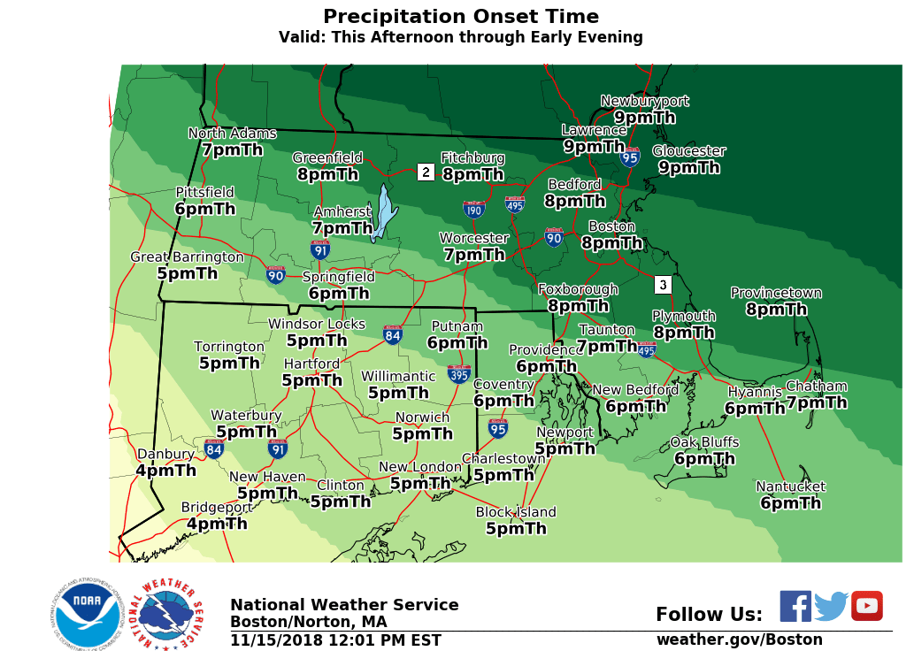
Snow totals increased ahead of Thursday-Friday storm

Published

on

According to the National Weather Service, today’s winter storm snow totals have been increased, & Winter Storm Warnings have been issued for much of interior SNE. Snow will move into CT by 4-5 PM & into the Boston area around 7-8 PM.

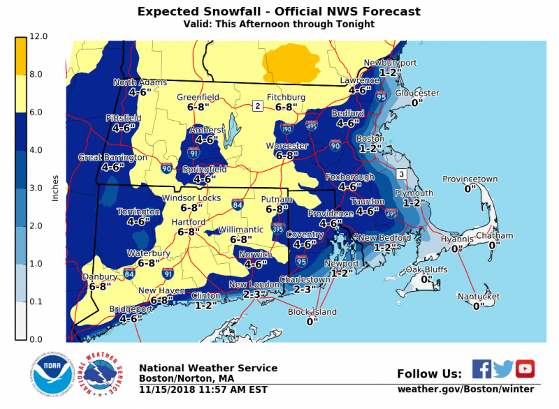
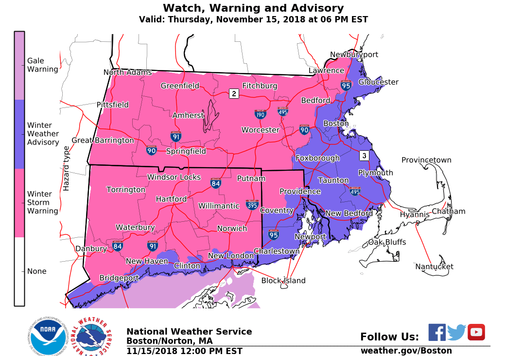
…WINTER WEATHER ADVISORY REMAINS IN EFFECT FROM 4 PM THIS AFTERNOON TO 1 AM EST FRIDAY…

* WHAT…Snow. Total snow accumulations 2 to 6 inches…except a coating to 2 inches on the very immediate coast. Winds gusting as high as 35 mph.

* WHERE…Portions of southeastern Massachusetts and northern and southern Rhode Island.

* WHEN…From 4 PM this afternoon to 1 AM EST Friday.

* ADDITIONAL DETAILS…Travel will become difficult especially  away from the immediate coast with a period of 1 to 2 inch per hour snowfall rates. The hazardous conditions could impact the latter half of the evening commute.

PRECAUTIONARY/PREPAREDNESS ACTIONS…

A Winter Weather Advisory for snow means periods of snow will cause primarily travel difficulties. Expect snow covered roads and limited visibilities, and use caution while driving. The latest road conditions for the state you are calling from can be obtained by calling 5 1 1.

This Afternoon
A chance of snow after 5pm. Cloudy, with a high near 32. East wind around 6 mph. Chance of precipitation is 30%. Total daytime snow accumulation of less than a half inch possible.
Tonight
Snow before 11pm, then rain and snow between 11pm and midnight, then rain after midnight. The snow could be heavy at times. Temperature rising to around 41 by 5am. East wind 8 to 15 mph, with gusts as high as 25 mph. Chance of precipitation is 100%. New snow accumulation of 3 to 7 inches possible.
Friday
Rain likely, mainly before 9am. Mostly cloudy, with a high near 46. East wind 7 to 13 mph becoming west in the afternoon. Winds could gust as high as 28 mph. Chance of precipitation is 70%. New precipitation amounts between a tenth and quarter of an inch possible.

Advertisement
Click to comment

Leave a Reply

Your email address will not be published. Required fields are marked *

Trending

Copyright © 2017 Fall River Reporter