

Community
Snow expected across MA and RI heading into the holiday
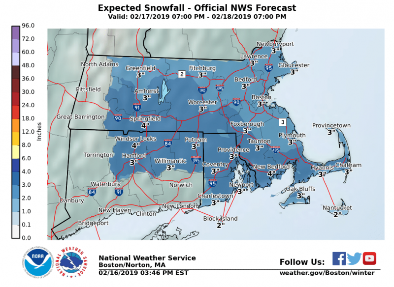
We have been very fortunate with lack of accumulating snow this winter, but it is only mid February and more is headed our way albeit not a major storm.
While specific snow accumulations remain uncertain, 2 to 4″ appears reasonable for many locations. Greatest risk for impacts through daybreak Monday will be south of the MA Turnpike, shifting to central/eastern MA by Mon afternoon.
According to the National Weather Service, Sunday night we should see snow, mainly after 11pm with a low around 29. Southeast wind 5 to 7 mph becoming calm. Chance of precipitation is 90%. New snow accumulation of 1 to 2 inches possible.

On Monday we should see snow and sleet, becoming all snow after 9am. High near 35. North wind 7 to 9 mph. Chance of precipitation is 90%. New snow and sleet accumulation of 1 to 2 inches possible.
On Monday night there is a chance of snow, mainly before 10pm. Mostly cloudy, with a low around 20. Northwest wind 7 to 10 mph. Chance of precipitation is 40%. New snow accumulation of less than one inch possible.
Its too early to tell, but the forecast for later in the week show snow Wednesday with freezing rain and sleet Thursday morning.


You must be logged in to post a comment Login