

Community
National Weather Service issues Hazardous Weather Outlook ahead of predicted wind and snow
While spring is almost here, wintry weather isn’t done with us yet.
A Hazardous Weather Outlook has been issued for northern Connecticut, central Massachusetts, eastern Massachusetts, northeastern Massachusetts, southeastern Massachusetts, western Massachusetts, northern Rhode Island and southern Rhode Island.
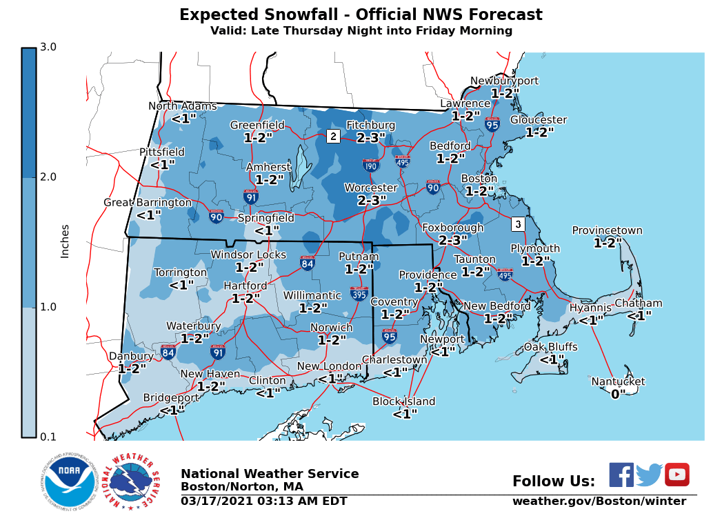
According to the National Weather Service, rain will change to snow late Thursday night into Friday morning. While the current expectation is for 1 to 3 inches of snow across most of the area, there is a low chance of some locations picking up as much as 4 or 5 inches.
Winter Weather Advisories may be issued in later forecasts if the potential increases for totals of 3 inches or more.
In addition, strong northeast winds may gust as high as 40 to 50 mph near the coast on Friday, which may require Wind Advisories to be issued in later forecasts.

The forecast:
Thursday
Showers, mainly after 2pm. Patchy fog after 5pm. High near 51. Calm wind becoming southwest around 5 mph in the afternoon.
Thursday Night
Rain showers and sleet before 4am, then rain showers, snow showers, and sleet likely. The rain could be heavy at times. Patchy fog before 7pm. Low around 31. Northeast wind 5 to 10 mph increasing to 12 to 17 mph after midnight. Winds could gust as high as 33 mph.
Friday
A chance of snow showers and sleet before 7am, then a chance of snow showers between 7am and 11am. Mostly cloudy, with a high near 34. Breezy, with a north wind 18 to 21 mph, with gusts as high as 37 mph.


You must be logged in to post a comment Login