

Community
Much of Massachusetts, Rhode Island and Connecticut expected to see first significant snow fall of the season
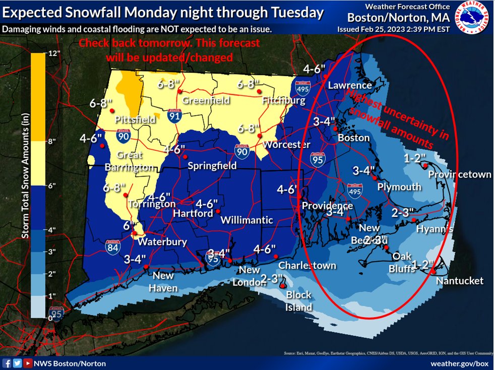
Massachusetts/Rhode Island/Connecticut – It looks like southern New England will see its first significant snowfall of the season early next week.
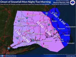
According to the National Weather Service, plowable snowfall is likely for much of the region Monday night into Tuesday. The bulk of the snow should arrive after the Monday evening rush hour but will impact the Tuesday morning commute with some improvement by the afternoon.
Keep in mind that the storm is 48 hours away and the forecast could change.
The current forecast:

Monday
A slight chance of rain between 2pm and 4pm, then a chance of snow. Mostly sunny, with a high near 39. Northwest wind 6 to 9 mph becoming east in the afternoon. Chance of precipitation is 30%. Little or no snow accumulation expected.
Monday Night
Snow before 4am, then rain between 4am and 5am. Low around 29. Breezy, with an east wind 11 to 20 mph, with gusts as high as 30 mph. Chance of precipitation is 100%. New snow accumulation of 3 to 5 inches possible.
Tuesday
Rain and snow before 1pm, then rain likely between 1pm and 3pm, then snow likely after 3pm. High near 40. Breezy, with a northeast wind 17 to 22 mph decreasing to 11 to 16 mph in the afternoon. Chance of precipitation is 90%.
Tuesday Night
A chance of snow before 1am. Partly cloudy, with a low around 29. Northwest wind 10 to 15 mph. Chance of precipitation is 50%.


You must be logged in to post a comment Login