

Community
Massachusetts, Rhode Island, Connecticut could see a half foot of snow this week
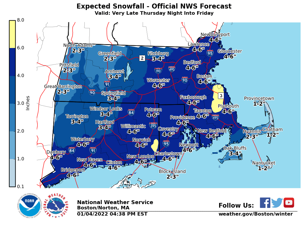
The Fall River area and beyond could see the first decent snowfall of the winter this week.
According to the National Weather Service, accumulating snow potential for late Thursday night into Friday could total up to 6″ of the white stuff.
The NWS says that a lot remains unclear regarding the potential storm that may bring accumulating snow to Southern New England late Thursday & Friday.
The first estimate of expected snow accumulations is reflected in the above graphic.
The amounts are subject to further adjustment, according to the NWS.
The forecast:

Wednesday
Rain, mainly after noon. South wind 10 to 18 mph, with gusts as high as 31 mph. New precipitation amounts between a tenth and quarter of an inch possible.
Wednesday Night
A chance of rain, mainly before 5am. Mostly cloudy. Southwest wind 10 to 13 mph, with gusts as high as 25 mph. New precipitation amounts of less than a tenth of an inch possible.
Thursday
Mostly sunny. West wind 6 to 10 mph, with gusts as high as 23 mph.
Thursday Night
Snow likely, mainly after 4am. Mostly cloudy. New snow accumulation of around an inch possible.
Friday
Snow, mainly before noon. Northeast wind 7 to 15 mph becoming northwest in the afternoon. Winds could gust as high as 30 mph. New snow accumulation of 3 to 5 inches possible.
Friday Night
Mostly clear. Northwest wind around 14 mph, with gusts as high as 24 mph.


You must be logged in to post a comment Login