
Community
Henri expected to become hurricane, current path headed for southern New England

As the area is expected to see the remnants of Fred tomorrow, an expected soon-to-be hurricane is on track to hit our area this weekend.
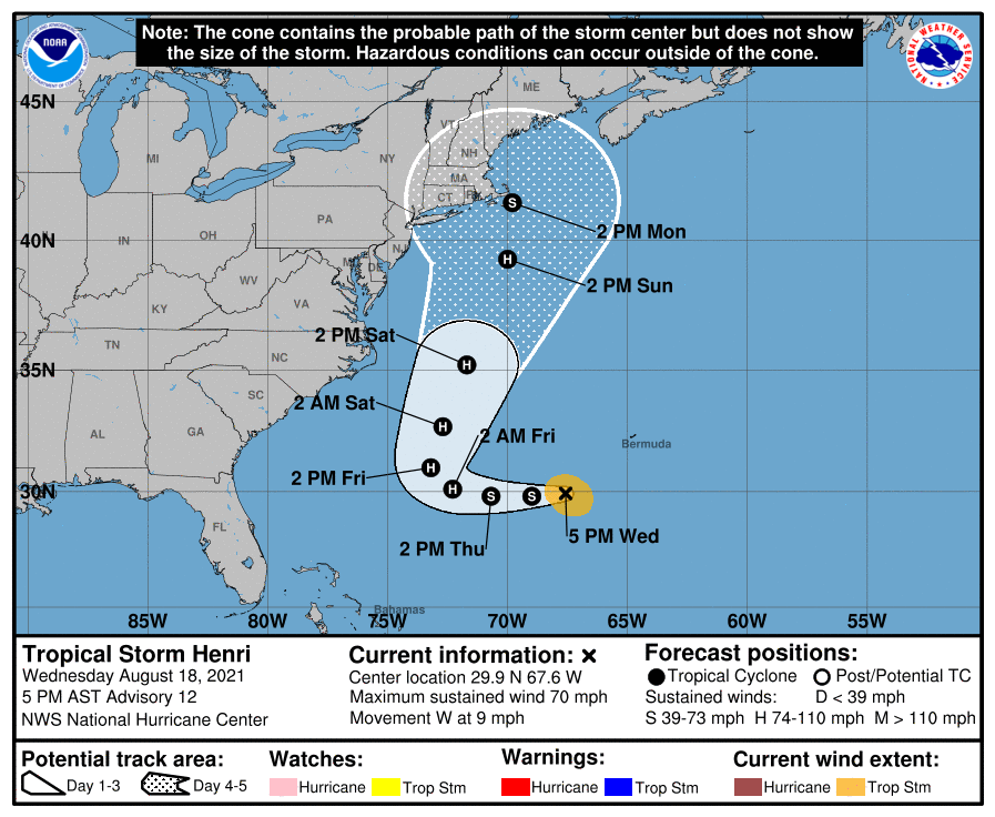
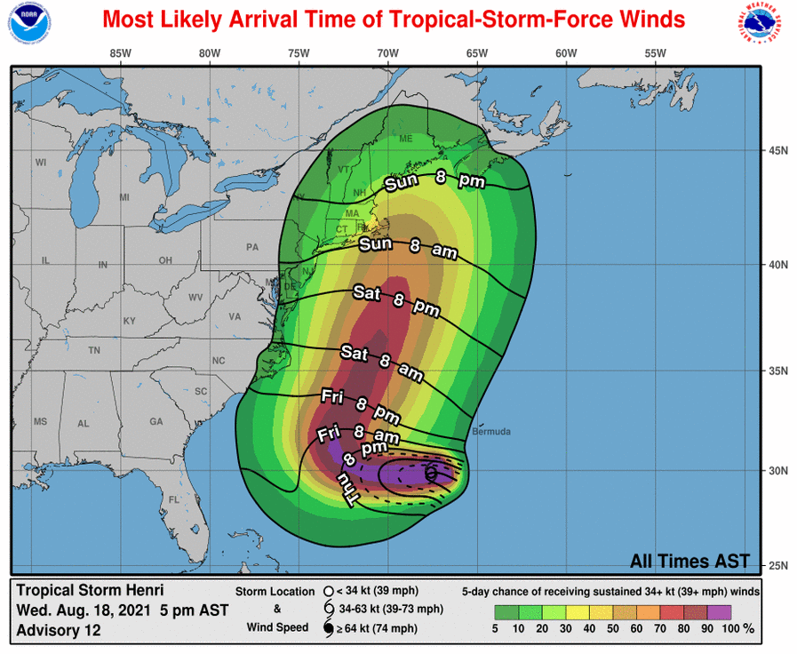
According to the NOAA, The forecast track of Henri has shifted toward the northeast coast of the U.S. this weekend and early next week, increasing the risk of direct storm surge, wind, and rain impacts in portions of the northeastern U.S. and Atlantic Canada during that time.
C
At 5 p.m. AST, the center of Tropical Storm Henri was located over the Atlantic Ocean about 235 miles (375 km) southwest of Bermuda and about 790 miles (1275 km) south of Nantucket, Massachusetts. Henri is moving toward the west near 9 mph (15 km/h) and this motion is expected to continue for another day or so. A turn to the north is expected on Friday with that motion continuing into the weekend.

Maximum sustained winds have increased to near 70 mph (110 km/h) with higher gusts. Tropical-storm-force winds extend outward up to 80 miles (130 km) from the center. The estimated minimum central pressure is 995 mb (29.39 inches). Little change in strength is forecast during the next day or so, but Henri is expected to become a hurricane on Friday.
Swells generated by Henri should continue to affect Bermuda during the next day or so. Swells are expected to increase across much of the east coast of the U.S. and Atlantic Canada later this week and this weekend. These swells could cause life-threatening surf and rip current conditions.


You must be logged in to post a comment Login