
Community
Heavy rain, thunderstorms, possible flooding to begin this evening
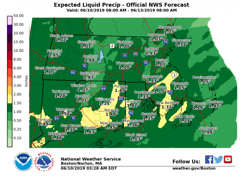
The National Weather Service has issued a statement on expected heavy rain, thunderstorms, and possible flooding.
Rain will overspread western Massachusetts and northern Connecticut between 3 and 6 pm this evening, reaching eastern Massachusetts and Rhode Island between 6 and 9 pm this evening.
Bands of heavy rain and a few embedded thunderstorms are expected to impact the region this evening into Tuesday morning. This will bring the potential for some poor drainage street flooding. In addition, more significant localized flooding is possible if the heavy rain remains over the same areas for several hours.
Motorists should be prepared for bands of heavy rainfall and some poor drainage street flooding this evening into Tuesday morning.

The forecast:
Tonight: Showers. Patchy fog after 9pm. Southeast wind around 6 mph, with gusts as high as 21 mph. Chance of precipitation is 80%. New precipitation amounts between a half and three quarters of an inch possible.
Tuesday: Showers, mainly before 11am. The rain could be heavy at times. Patchy fog before noon. Light and variable wind becoming northwest 5 to 10 mph in the morning. Winds could gust as high as 22 mph. Chance of precipitation is 90%. New precipitation amounts between a half and three quarters of an inch possible.


You must be logged in to post a comment Login