
Community
Hazardous Weather Outlook issued to end the weekend into Monday
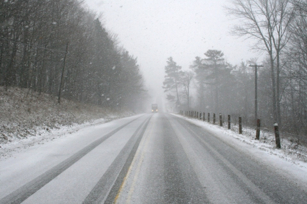
Some wintry weather is expected to end the weekend into Monday.
According to the National Weather Service, a Hazardous Weather Outlook has been issued for northern Connecticut, central Massachusetts, eastern Massachusetts, northeastern Massachusetts, southeastern Massachusetts, western Massachusetts, and Rhode Island.
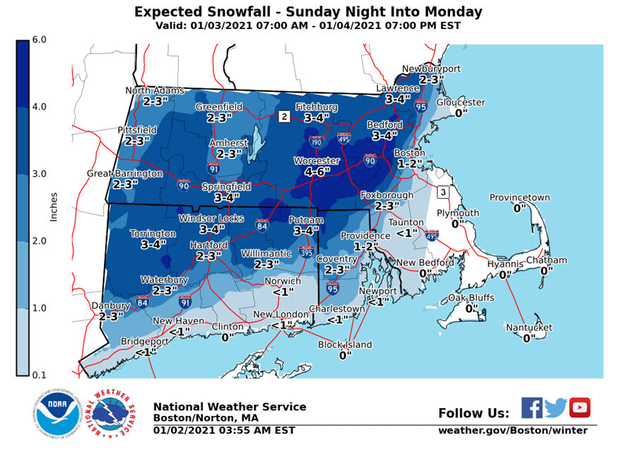
Accumulating snow is expected northwest of the I-95 corridor Sunday night into Monday. The NWS is expecting 2 to 6 inches of wet snow in this region. The result will cover roads with snow Sunday night and into the Monday morning rush hour. This will also be a wet snow, so if the higher amounts are realized, there will be the risk for isolated power outages. Along and southeast of the Boston to Providence corridor, rain is expected, but it is possible the precipitation ends as a period of wet snow. The greatest uncertainty in the forecast is the area near the Boston to Providence corridor near the rain/snow line which could mean possibly more snow for the areas just east of Providence than currently predicted.
The forecast:

Sunday
A chance of rain, mainly after 5pm. Increasing clouds, with a high near 40. East wind 6 to 8 mph. Chance of precipitation is 30%.
Sunday Night
Rain before 2am, then rain and snow. Low around 35. Northeast wind 7 to 9 mph, with gusts as high as 20 mph. Chance of precipitation is 90%.
Monday
Snow likely before 7am, then rain and snow likely between 7am and 10am, then a chance of rain after 10am. Cloudy, with a high near 41. North wind 10 to 14 mph, with gusts as high as 25 mph. Chance of precipitation is 70%.
Monday Night
A slight chance of rain before 8pm, then a slight chance of snow. Mostly cloudy, with a low around 32. Northwest wind 8 to 10 mph. Chance of precipitation is 20%.


You must be logged in to post a comment Login