
Community
Hazardous Weather Outlook issued as strong winds, sub zero wind chills likely
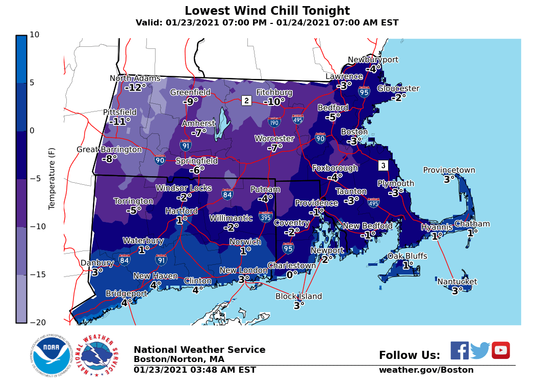
While we have been experiencing a mild winter, tonight and tomorrow we will see the coldest weather of the winter so far.
A Hazardous Weather Outlook has been issued by the National Weather Service for eastern Massachusetts, northeastern Massachusetts, southeastern Massachusetts, northern Rhode Island and southern Rhode Island.
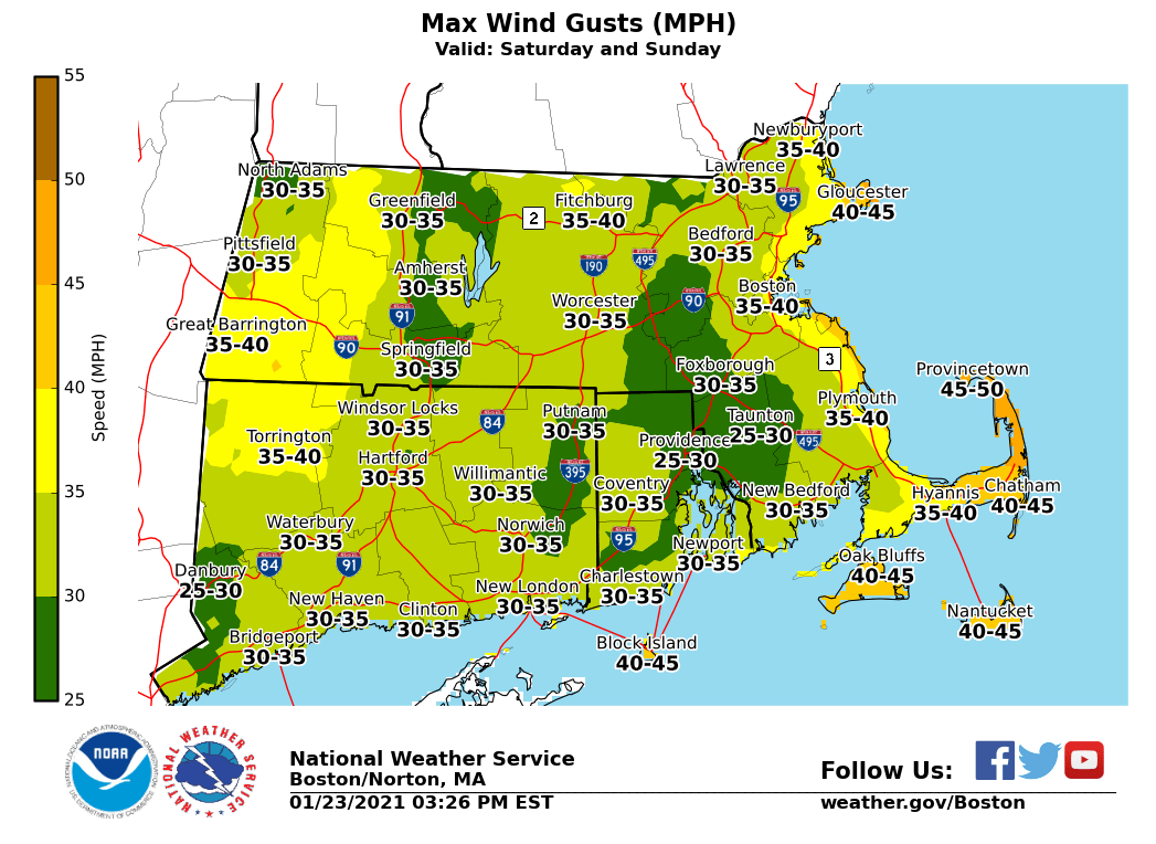
According to the NWS, the Wind Advisory is in effect for the strongest winds on Cape Cod overnight. Winds could blow around unsecured objects and tree limbs could be blown down. The Wind Advisory may be expanded.
Despite the frigid wind chill feel like temperatures, the rest of the weekend should be sunny.

A chance of snow showers forecast for Tuesday and Thursday afternoon will otherwise leave a dry week through next weekend.
Tonight
Clear, with a low around 16.
Sunday
Sunny, with a high near 31.
Sunday Night
Mostly clear, with a low around 19.


You must be logged in to post a comment Login