
Community
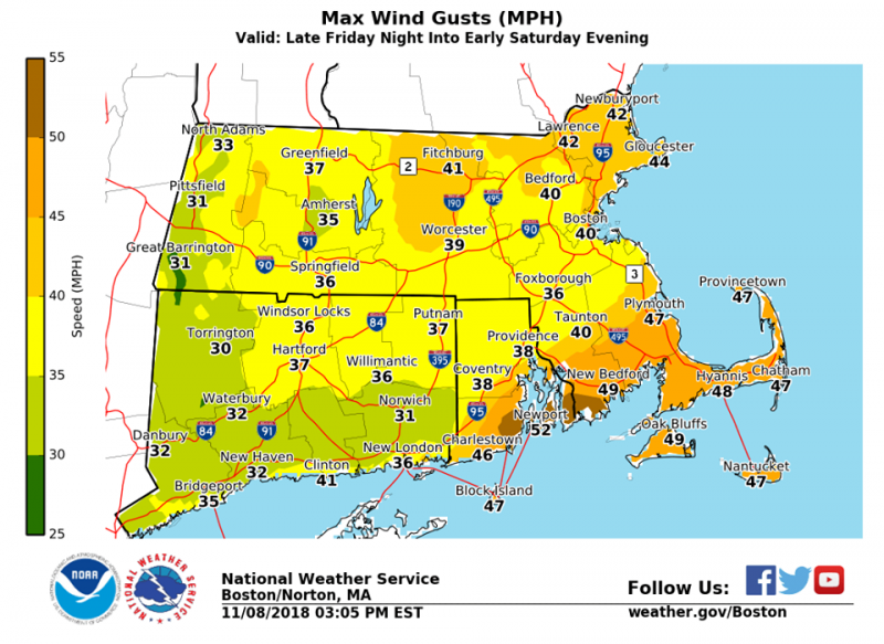
Flood Watch issued for most of the area, strong winds expected
The National Weather Service in Boston/Norton has issued a Flood Watch for portions of northern Connecticut, Massachusetts, and Rhode Island, including the following
areas, in northern Connecticut, Hartford, Tolland, and Windham. In Massachusetts, Bristol, Essex, Franklin, Hampden, Hampshire, Middlesex, Norfolk, Plymouth, Suffolk, and
Worcester. In Rhode Island, Bristol, Kent, Newport, Providence, and Washington.
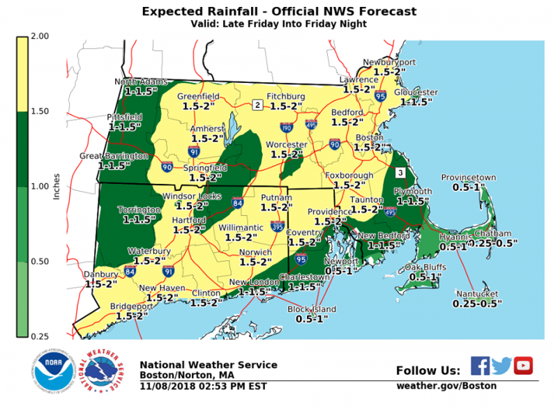
From Friday evening through Saturday afternoon a widespread soaking rainfall is forecast during Friday evening and Friday night. One to 2 inches of rainfall is forecast, with
isolated higher totals up to 2.5 inches.
This rainfall will bring the potential for significant urban and poor drainage flooding. Any leaf-clogged storm drains will exacerbate this potential. The rains may also bring some area rivers and streams into flood. Although Saturday is expected to be dry, some area rivers will take longer to crest, hence there is a chance that some rivers may go into flood during Saturday.
PRECAUTIONARY/PREPAREDNESS ACTIONS

A Flood Watch means there is a potential for flooding based on current forecasts.
You should be alert for possible Flood Warnings. Those living in areas prone to flooding should be prepared to take action should flooding develop.


You must be logged in to post a comment Login