
Community
Flood Watch, Coastal Flood Advisory, and High Wind Warning issued for area
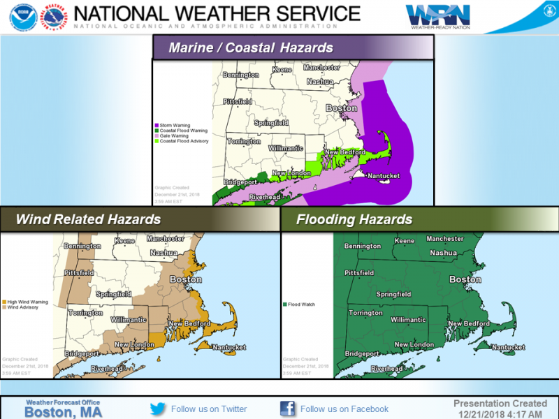
The National Weather Service has issued a Flood Watch and Wind Advisory for the area.
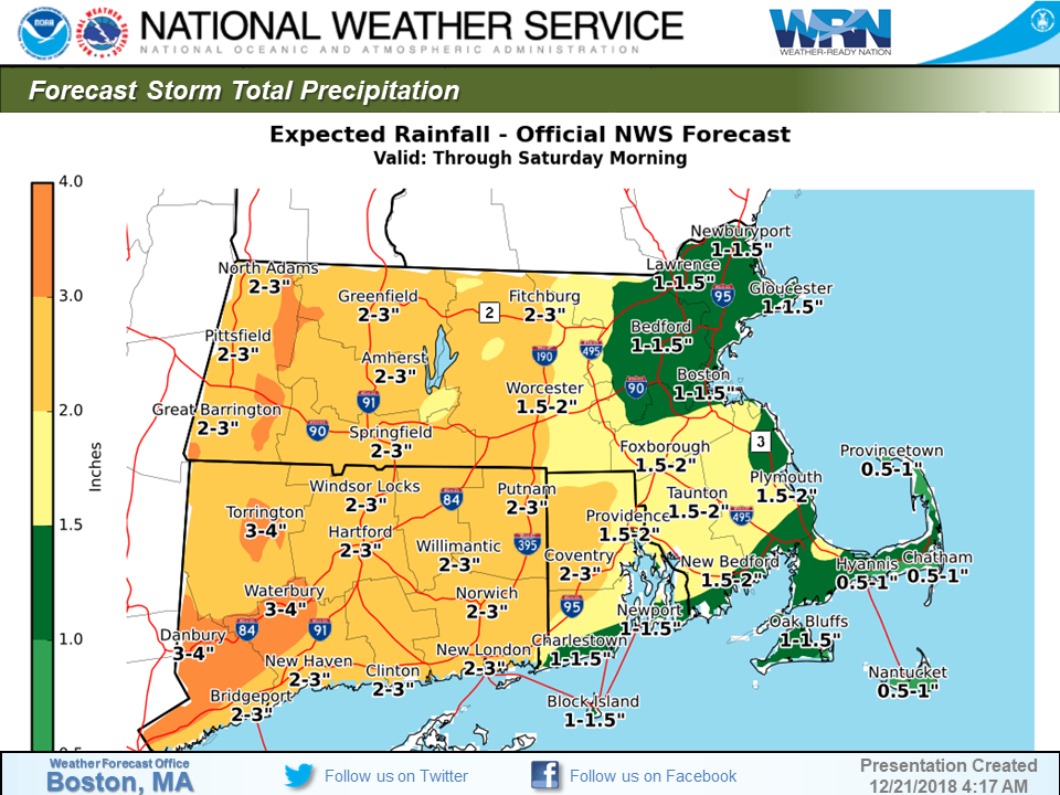
A Flood Watch continues for all of southern New England through late Friday night.
Periods of heavy rain late tonight and Friday will bring widespread rainfall totals of 2 to 3 inches, with as much as 4 inches in parts of western and central Massachusetts and northern Connecticut.
Significant urban flooding of roads, underpasses, and low lying areas is expected. Roads that normally flood in heavy rain may require closures. Minor flooding of mainstem rivers is possible.
A Flood Watch means there is a potential for flooding based on current forecasts.
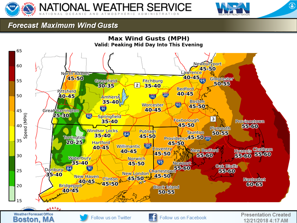
The National Weather Service in Boston/Norton has also issued a High Wind Warning, which is in effect from 7 AM this morning to 10 PM EST this evening. The Wind Advisory is no longer in effect.

Winds will be South 20 to 30 mph with gusts up to 50 to 60 mph.
Strong winds may blow down limbs, trees, and power lines. Scattered power outages are expected for South Coastal Rhode Island and Massachusetts, including Block Island.
A High Wind Warning is issued when sustained winds of 40 mph are expected for at least one hour, with gusts of 58 mph or greater at any time. Damage to trees, power lines, and property are possible with winds of this magnitude. Power outages are likely. Take action to secure loose outdoor objects.
A Coastal Flood Advisory will also be in effect from 4 PM this afternoon to 9 PM EST this evening.


You must be logged in to post a comment Login