

Community
Flash Flood Watch issued for southern New England due to Tropical Storm Fay
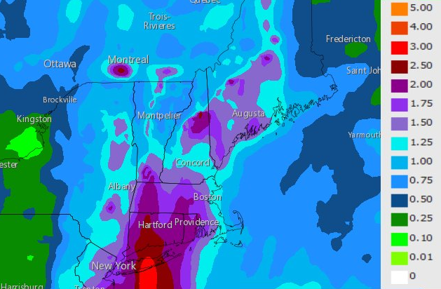
Strong wind and heavy rains are expected for southern New England in the coming days.
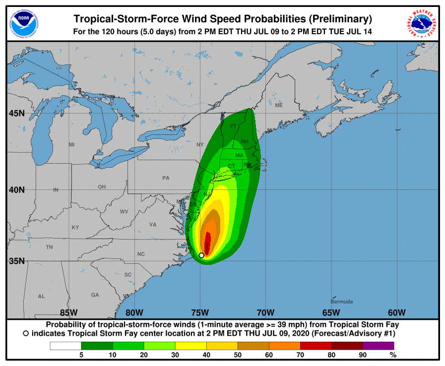
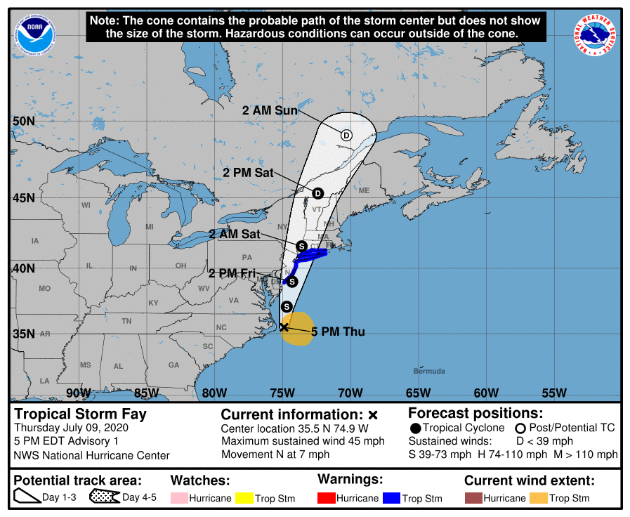
According to the National Weather Service, Tropical Storm Fay formed this afternoon 40 miles east of Cape Hatteras NC. Max winds are 45 mph, mostly on the east side. Fay will move along the mid Atlantic coast & inland over the northeast Friday to Saturday. Heavy rain, flash flooding & rip currents will be the main impacts from Fay.
The National Weather Service in Boston/Norton has issued a Flash Flood Watch for Connecticut, Massachusetts, and Rhode Island from Friday afternoon through Saturday morning.
Rainfall of 1 to 2 inches is expected across southern New England. The heaviest rainfall will occur Friday night into Saturday morning, where locally higher amounts may occur and cause flash flooding.

Significant flooding of urban areas and small streams is possible.
A Flash Flood Watch means that conditions may develop that lead to flash flooding. Flash flooding is a very dangerous situation.
The area could also see tropical storm force winds depending on Fay’s track.


You must be logged in to post a comment Login