Community
Flash Flood Watch annnounced as Tropical Storm Erin expected to bring heavy rain, flooding to parts of southern New England

The National Weather Service has issued a hazardous weather outlook for the area and a Flash Flood Watch.
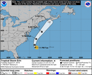
Tropical Storm Erin will pass offshore this week and is expected to bring some wet weather to the area today.
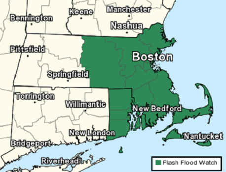
The National Weather Service in Boston/Norton has issued a Flash Flood Watch for central and eastern Massachusetts including Cape Cod and the Islands, as well as all of Rhode Island from this afternoon into early Thursday morning.
Bands of showers with pockets of torrential rainfall will overspread the region from south to north this afternoon and continue at times through tonight. Rainfall amounts will vary considerably across the region, but a general 1 to 3 inches are expected. Localized pockets of 4 to 5 inch amounts are possible over a short period of time, where bands of torrential rainfall are persistent.
The heavy rain will bring the potential for localized flash flooding. Significant urban flash flooding is also possible in heavy rainfall trains over a vulnerable urban center.
A Flash Flood Watch means that conditions may develop that lead to flash flooding. Flash flooding is a very dangerous situation.


You must be logged in to post a comment Login