

Community
Fall River, New Bedford area still under Winter Storm Watch, but forecast has changed
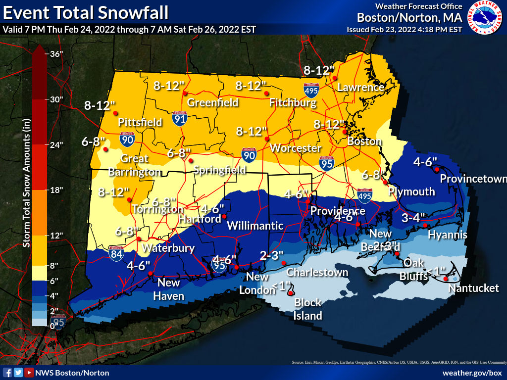
While the Fall River and New Bedford area is still expected to see plowable snow, the forecast has changed.
According to the National Weather Service, a Winter Storm Watch is in effect from late Thursday night until Friday evening.
Heavy snow is forecast with this storm where total snow accumulations of 3 to 5 inches are possible on the Southcoast and snow totals from 5 inches to a foot for communities north of Fall River/New Bedford are expected.
Winds are expected to gust as high as 35 mph.

Plan on slippery road conditions during and after the storm. To make matters worse, the hazardous conditions could impact the morning or evening commute.
Snowfall rates of an inch per hour or greater are possible for a period of time before changeover to mixed precipitation.
The snow is expected to begin falling after midnight (Thursday night/Friday morning). The flakes are expected to turn into rain and sleet around noontime on Friday and then possibly change back to snow Friday evening.


You must be logged in to post a comment Login