
Community
Coastal storm could bring several inches of rain, flooding, damaging wind gusts
Don’t be fooled by a beautiful day on Sunday, stormy weather is once again in the forecast. We could be in store for some messy weather in the coming days.
According to the National Weather Service, there is the potential for a slow moving significant coastal storm. The storm is expected to begin late Monday night and continue through Wednesday.
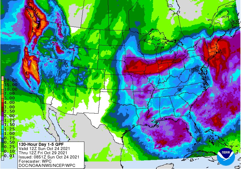
While the NWS says that the exact details are still uncertain, the information coming in suggests that most of New England could see several inches of rain as the above illustration indicates.
In addition to heavy rain and flooding for the area, potential impact also includes damaging wind gusts and minor coastal flooding/beach erosion in the coming days.
The forecast:
Tonight
Rain likely, mainly after 2am. Patchy fog after 5am. Otherwise, increasing clouds.
Monday
Rain likely, mainly before 7am. Patchy fog before 10am.

Monday Night
Rain likely, with thunderstorms also possible after 9pm. Some of the storms could produce heavy rain. Patchy fog
Tuesday
Rain. Patchy fog. Wind gusts as high as 30 mph.
Tuesday Night
Rain. Wind gusts as high as 50 mph.
Wednesday
Rain likely, mainly before 11am. Wind gusts as high as 41 mph.
Wednesday Night
A chance of showers. Wind gusts as high as 29 mph.
Thursday
A chance of rain. Wind gusts as high as 28 mph.


You must be logged in to post a comment Login