

Community
Area upgraded to Winter Storm Warning as part of south coast could see up to a foot of snow
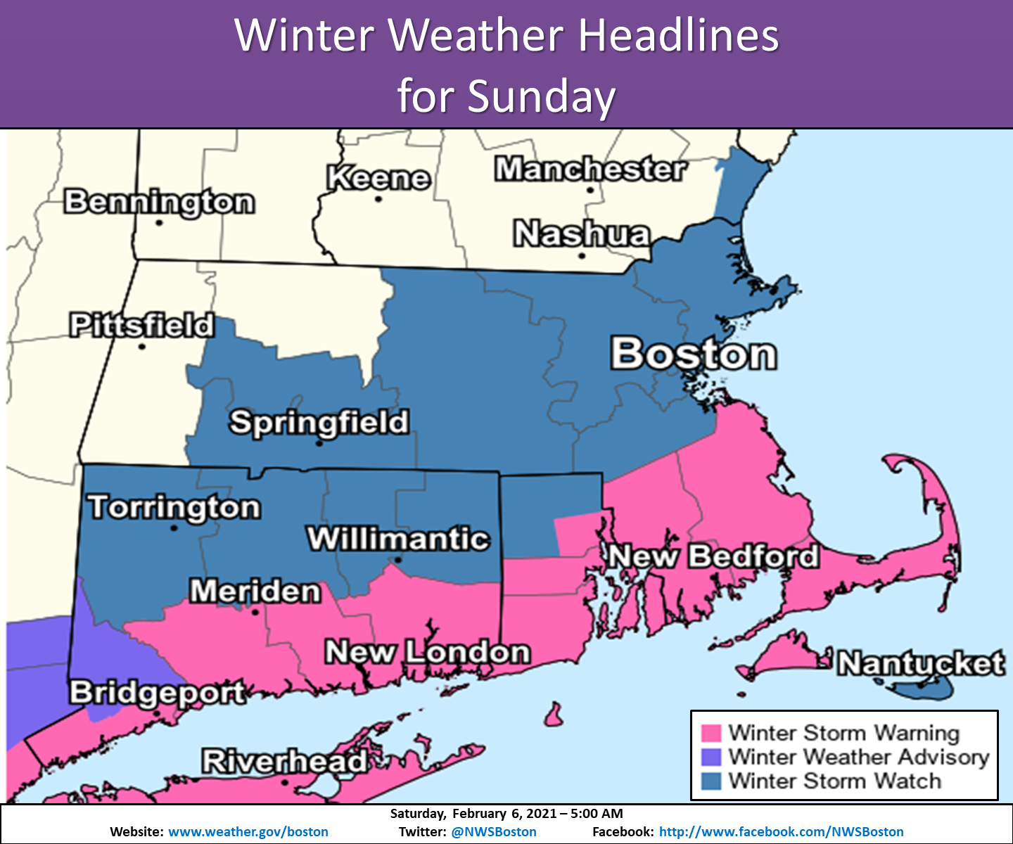
Southeastern Massachusetts has seen an upgrade from a Winter Storm Watch for the expected storm this weekend as expected snow totals have also been increased.
The National Weather Service has issued a Winter Storm Warning from 7:00 a.m. Sunday to 1:00 a.m. EST Monday for portions of southeastern Massachusetts as well as central and southern Rhode Island. The rest of the area remains in a Winter Storm Watch.
Graphic courtesy of National Weather Service
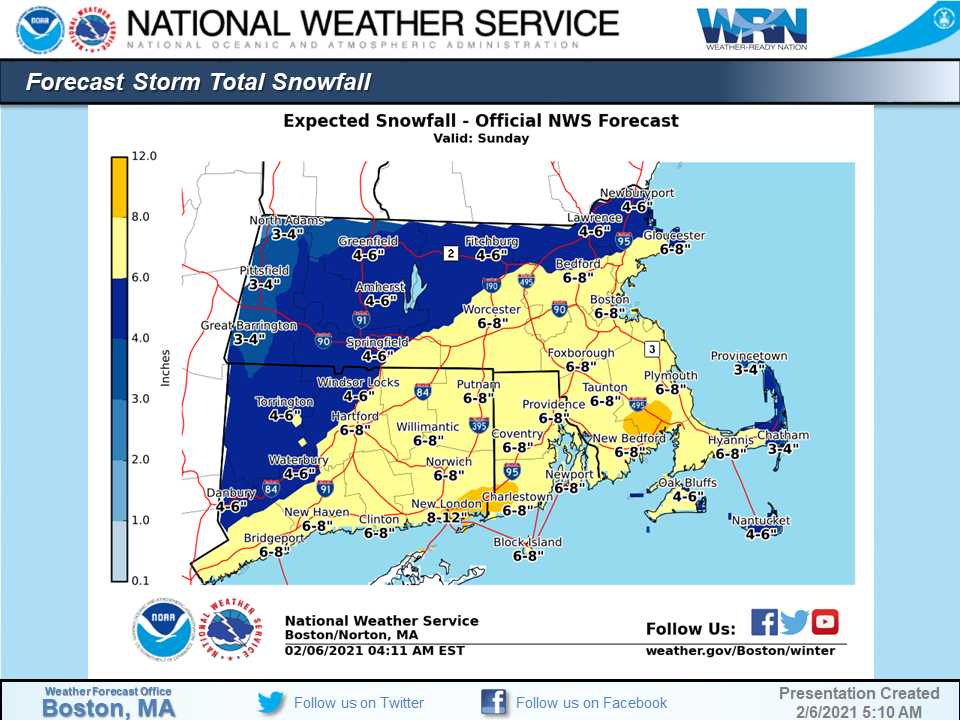
Heavy wet snow is expected with total snow accumulations of 5 to 9 inches possible while a small area of the south coast could see up to a foot of snow.
Winds gusting as high as 40 mph are also expected.

The heaviest snow is expected Sunday afternoon with 1 to 2 hour snowfall rates possible a times.
Snowfall is expected to begin between 8-10:00 a.m. and end between 6-8:00 p.m.
Travel will be very difficult.
Heavy wet snow may result in the potential for some power outages and downed tree limbs.
The NWS recommends that if you must travel, keep an extra flashlight, food, and water in your vehicle in case of an emergency.


You must be logged in to post a comment Login