

Community
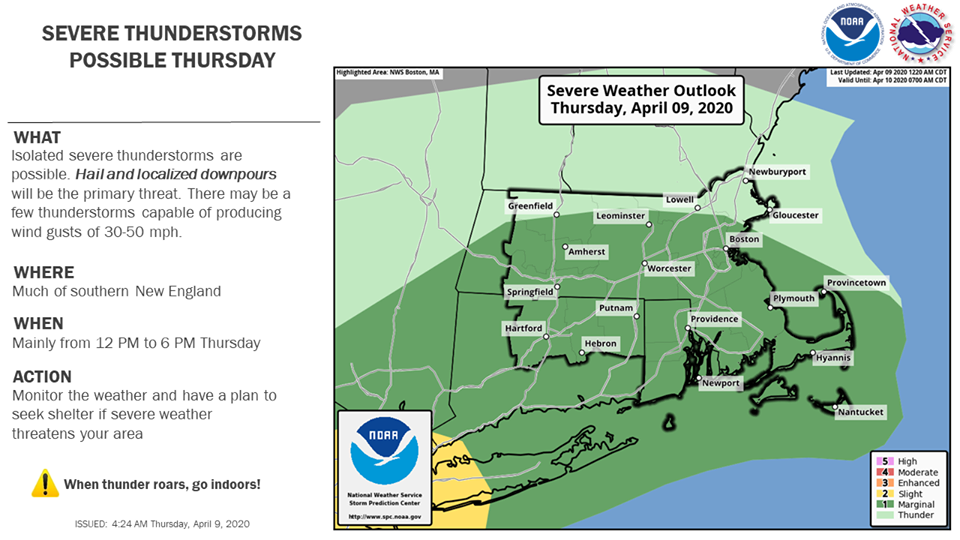
Area under Wind Advisory as downpours, severe thunderstorms possible

A Wind Advisory has been issued by the National Weather Service as severe weather is possible later today.
West winds 20 to 30 mph with gusts up to 50 mph are expected in portions of northern Connecticut, central, eastern, northeastern, southeastern and western Massachusetts and northern and southern Rhode Island.
The Wind Advisory is in place from 4 PM this afternoon to 9 PM EDT this evening.
Gusty winds could blow around unsecured objects. Tree limbs could be blown down and a few power outages may result.
Use extra caution when driving, especially if operating a high profile vehicle. Secure outdoor objects.
There is also a risk for thunderstorms this afternoon, and some of these could be strong to severe. The main threats are from hail and locally heavy rain.

The forecast:
Today
Showers likely, then showers and possibly a thunderstorm after 2pm. Some of the storms could produce heavy rain. Patchy fog after 3pm. High near 59. Breezy, with a south wind 6 to 11 mph increasing to 16 to 21 mph in the afternoon. Winds could gust as high as 34 mph. Chance of precipitation is 90%. New rainfall amounts between a half and three quarters of an inch possible.
Tonight
Scattered showers, mainly before 8pm. Cloudy during the early evening, then gradual clearing, with a low around 39. West wind 15 to 18 mph, with gusts as high as 46 mph. Chance of precipitation is 30%. New precipitation amounts of less than a tenth of an inch possible.
Friday
Isolated showers after 2pm. Increasing clouds, with a high near 49. Breezy, with a west wind 17 to 20 mph, with gusts as high as 34 mph. Chance of precipitation is 20%.


You must be logged in to post a comment Login