

Community
After a nice Saturday, heavy rain and wind is headed our way
Hope you had some time to enjoy the nice weather today as rain and clouds are headed to our area for much of the week.
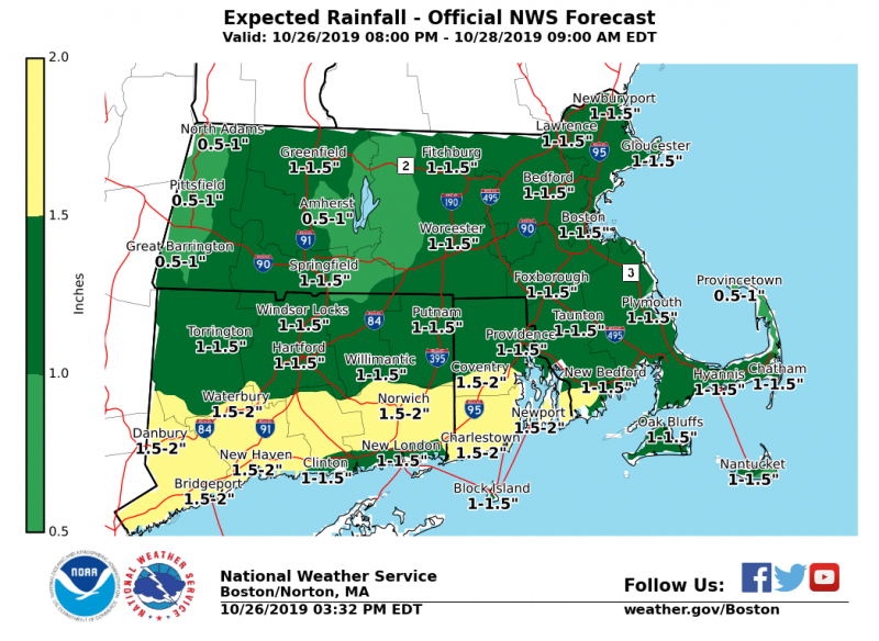
According to the National Weather Service, rain to overspread late tonight/early Sunday in western MA/CT. Heaviest rains will take place early afternoon to late night Sunday. With this amount of rain, nuisance minor flooding is possible in areas where storm drains are clogged by leaves.
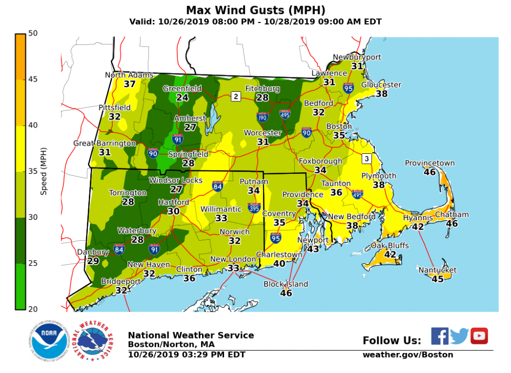
Period of gusty winds 45-50 mph could produce sporadic tree damage towards Cape Cod, the Islands into Block Island Sunday afternoon into mid-evening. Gale Warnings are also in effect for most coastal and offshore waters except for Boston Harbor.

The forecast:
Sunday
Rain, mainly after 11am. The rain could be heavy at times. Patchy fog after 2pm. Southeast wind 5 to 11 mph, with gusts as high as 31 mph. Chance of precipitation is 100%.
Sunday Night
Rain and possibly a thunderstorm before 11pm, then a slight chance of rain between 11pm and 1am. Some of the storms could produce heavy rainfall. Patchy fog before 2am. Low around 49. Southeast wind 6 to 8 mph becoming northwest after midnight. Chance of precipitation is 80%.
A chance of showers, drizzle, or rain is in the forecast for every day this coming week until Saturday.


You must be logged in to post a comment Login