

Community
Accumulating snow expected through much of the area
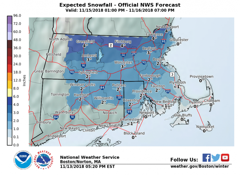
Ready for snow? Many locations across the area are expecting accumulating snow later this week according to the National Weather Service.
Another storm impacts the region late Thursday into Friday with rain, snow and ice. There is the potential for some snow and ice accumulation in the interior.
Here is the local forecast for the coming days from the National Weather Service:
Tonight
Cloudy, then gradually becoming partly cloudy, with a low around 32. Northwest wind 14 to 16 mph, with gusts as high as 31 mph.
Wednesday
Sunny, with a high near 37. Northwest wind 14 to 18 mph, with gusts as high as 32 mph.

Wednesday Night
A slight chance of snow showers after 4am. Mostly clear, with a low around 23. North wind 7 to 11 mph. Chance of precipitation is 20%.
Thursday
A chance of rain between 2pm and 5pm, then a chance of snow after 5pm. Increasing clouds, with a high near 37. North wind around 7 mph becoming east in the afternoon. Chance of precipitation is 40%. .
Thursday Night
Snow and sleet before 9pm, then rain. Low around 34. East wind 8 to 17 mph, with gusts as high as 28 mph. Chance of precipitation is 90%.
Friday
Rain, mainly before noon. High near 48. Chance of precipitation is 80%.


You must be logged in to post a comment Login