

Community
Southern New England issued High Wind Watch ahead of soaking coastal storm that could bring 6 inches of rain
We are in store for some messy weather in the coming days as the forecast has worsened.
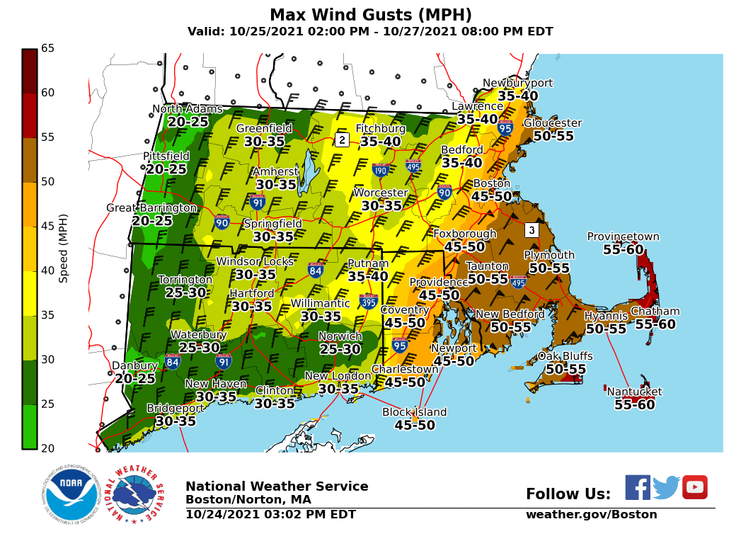
Portions of eastern, northeastern and southeastern Massachusetts and northern and southern Rhode Island have been issued a High Wind Watch from Tuesday morning through Wednesday afternoon as wind gusts could get as high as 60 mph.
Damaging winds could blow down trees and power lines. Power outages are possible. Travel could be difficult, especially for high profile vehicles.
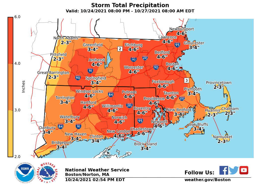
According to the National Weather Service, there is the potential for a slow moving significant coastal storm. The storm is expected to begin late Monday night and continue through Wednesday.
While the NWS says that the exact details are still uncertain, the information coming in suggests that most of New England could see up to 6 inches of rain as the above illustration indicates.
In addition to heavy rain and damaging wind gusts, potential impact also includes coastal flooding/beach erosion in the coming days.
The forecast:

Tonight
Rain likely, mainly after 2am. Patchy fog after 5am. Otherwise, increasing clouds.
Monday
Rain likely, mainly before 9am. Patchy fog before 7am.
Monday Night
Rain likely, with thunderstorms also possible after 9pm. Some of the storms could produce heavy rain. Patchy fog
Tuesday
Rain that could be heavy at times. Patchy fog. Wind gusts as high as 30 mph.
Tuesday Night
Rain. Wind gusts as high as 50 mph.
Wednesday
Rain likely, mainly before 11am. Wind gusts as high as 41 mph.
Wednesday Night
A chance of rain. Wind gusts as high as 26 mph.
Thursday
A chance of rain.


You must be logged in to post a comment Login